
Urban Tree Canopy Assessments: Why Do Trees Matter?

The PlanIT Geo™ Geospatial Mapping Services team is passionate about the importance of a quality urban tree canopy assessment.
In this blog series, you will learn more about the process, why you need one, and how an urban tree canopy assessment will benefit your community.
Part 1: Why Do Trees Matter?
Trees are the answer! Across cities and other urbanized areas, trees along streets, in parks, yards, and natural areas constitute a valuable urban and community forest. This resource is a critical element of the region’s green infrastructure, contributing to environmental quality, public health, water supply, the local economy, and aesthetics.
Trees throughout the world face many threats, but trees in an urban environment are especially vulnerable. Clear-cutting, compacted soils, and vandalism are just a few of the many threats these trees face. This valuable resource is under attack from many different directions in communities, small and large, across the globe. The following maps and images show examples of large-scale changes that can occur in an urban forest.
Trees are one of the few infrastructure investments that grow in value over time.
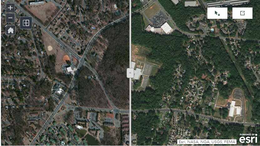
Land Development
Land Development
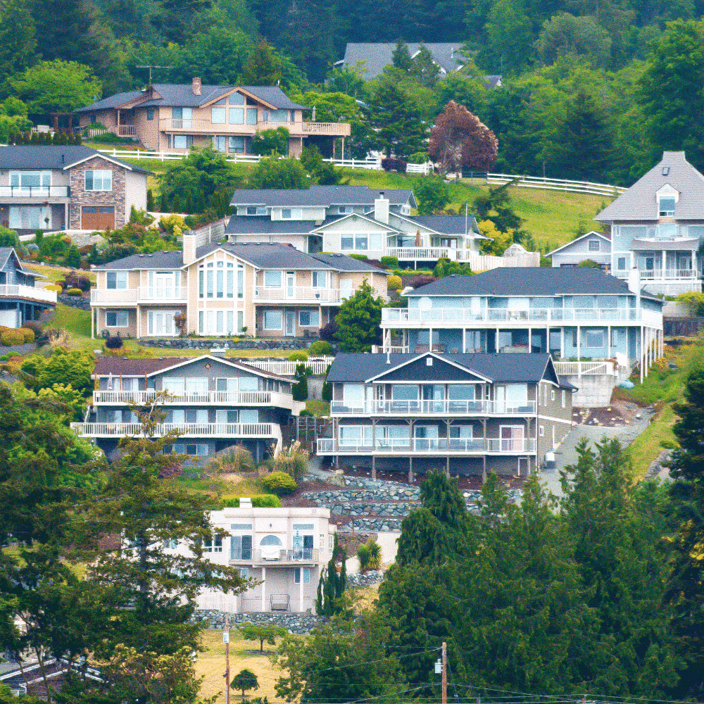
Charlotte, North Carolina, in the southeastern United States, is a rapidly growing city. With high rates of growth often comes a high level of development. Large, forested areas are quickly being cleared to make way for new housing developments, schools, and other amenities. Fortunately, the City has been planting new trees to make up for the losses, but those trees take time to grow and mature. The left image shows conditions in 2014, and the right image shows the same area in 2020 after a new school has been built where a forest once stood.
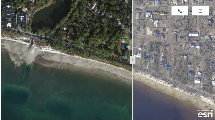
Severe Storms
Panama City, Florida, on the coast of the Gulf of Mexico, was devastated by category 5 hurricane, Michael, in October of 2018. It’s estimated that the strong winds and rain took down 1,000,000 trees in Panama City alone. Local residents are now literally feeling the impacts of losing their tree canopy with reports of higher than normal temperatures and the threat of wildfires and flooding due to the downed trees. The map shows pre-storm (left-2014) and post-storm (right-2020) conditions. Read our blog post to learn more about trees and natural disasters.
Severe Storms
“
Trees throughout the world face many threats, but trees in an urban environment are especially vulnerable.
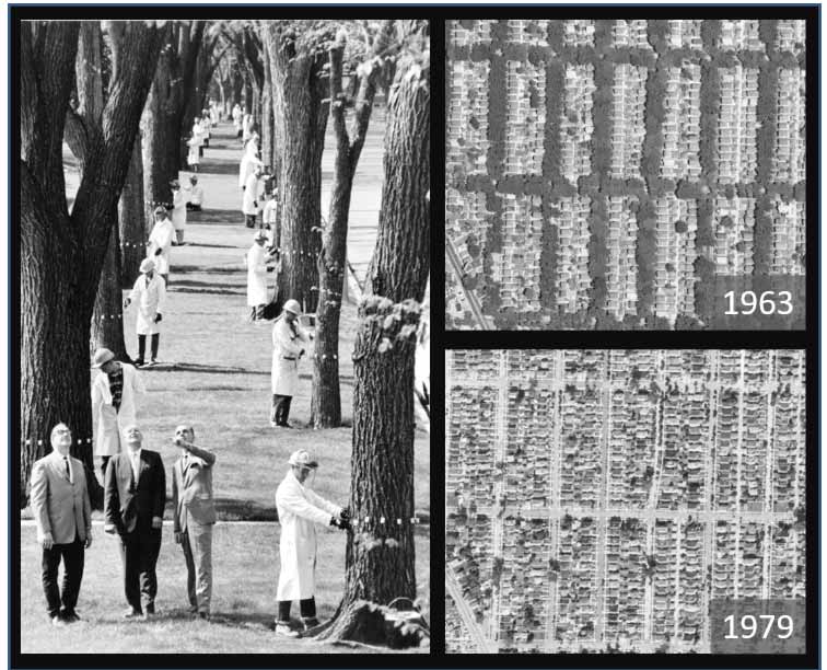
Pest Control
Pests and Diseases
Invasive species, pests, and disease present one of the most serious threats to urban and community forests. The City of Milwaukee, Wisconsin experienced a significant loss of urban tree canopy due to Dutch elm disease. This led to the removal of over 140,000 elms from the late 1950s to the present time. This image shows the dramatic change that occurred in many areas throughout the city. Once fully canopy-covered streets became open and exposed corridors due to monoculture planting and the subsequent disease outbreak.
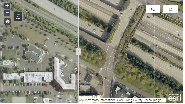
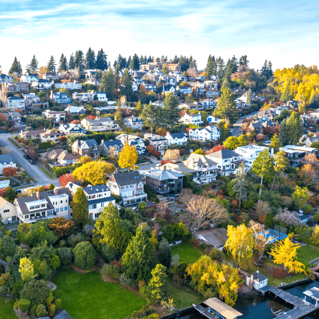
Tree Planting
Around the world, the value that trees provide to people and the environment is being realized. Many cities are initiating tree planting programs in order to engage the community and expand their urban forest. Tree canopy assessments provide detailed information on where there are trees and also where there is available space to plant new trees. As seen in the map, the City of Mercer Island, Washington, has placed a strong emphasis on its tree-planting program. Their efforts can be seen in the large number of trees planted along the Mountains to Sound Greenway. These trees were planted in the late-1990s and have seen tremendous growth in the last 20 years (left-2002, right-2015), providing enhanced recreation opportunities, increased wildlife habitat connections, and improved air and sound quality.
Tree Planting
This blog series will continue to explore the necessity of urban tree canopy assessments and how one will positively impact your community. Please join us over the next month as we continue to share this valuable topic.
Blog Series: Urban Tree Canopy Assessments
Part 1: Why Do Trees Matter?
Part 2: The Benefits of Trees
Part 3: What Is An Urban Tree Canopy Assessment?
Part 4: What Will I Get Out Of An Urban Tree Canopy Assessment?
View our interactive Urban Tree Canopy Assessments Story Map and learn how our Geospatial Mapping Services team can support your community forestry goals.
Related Resources
Blog
Part 2, Urban Tree Canopy Assessments Blog Series: The Many Benefits of Trees

Urban Tree Canopy Software
View, Plan, and grow your urban forest with TreePlotter™ CANOPY. Easily and clearly present your urban tree canopy to your stakeholders.
GNSS for Arborists
In this paper, we provide information on the integration of 3rd party GNSS (Global Navigation Satellite System) receivers with the tree inventory software TreePlotter™ created by PlanIT Geo™ to obtain precise spatial location while collecting data in the field.
Urban Tree Canopy Assessment
Regional assessment of tree canopy cover and plantable space for 12 municipalities including tree canopy correlations with sociodemographics
Stay Up To Date With The Latest News and Events
Join Our Community
Stay informed on the urban forestry industry with our monthly TREEbune newsletter, live webinars, and industry-specific content delivered to your inbox.
Urban Forestry Webinars
PlanIT Geo has a substantial on-demand webinar library. Get CEU credits, grow your knowledge base, and stay current on cutting edge industry technology.
Follow Us
We love to share industry-related news, software tutorials, blogs, and company news across our social channels.
Stay Up To Date With The Latest News and Events
Join Our Newsletter
Stay informed on the urban forestry industry with our monthly TREEbune newsletter, live webinars, and industry-specific content delivered to your inbox.
Urban Forestry Webinars
PlanIT Geo has a substantial on-demand webinar library. Get CEU credits, grow your knowledge base, and stay current on cutting edge industry technology.
Follow Us
We love to share industry-related news, software tutorials, blogs, and company news across our social channels.