What You Need to Know About Urban Tree Canopy and Artificial Intelligence.
Dive into the details on our novel approach to tree canopy data
December 27, 2021 | Alec Sabatini
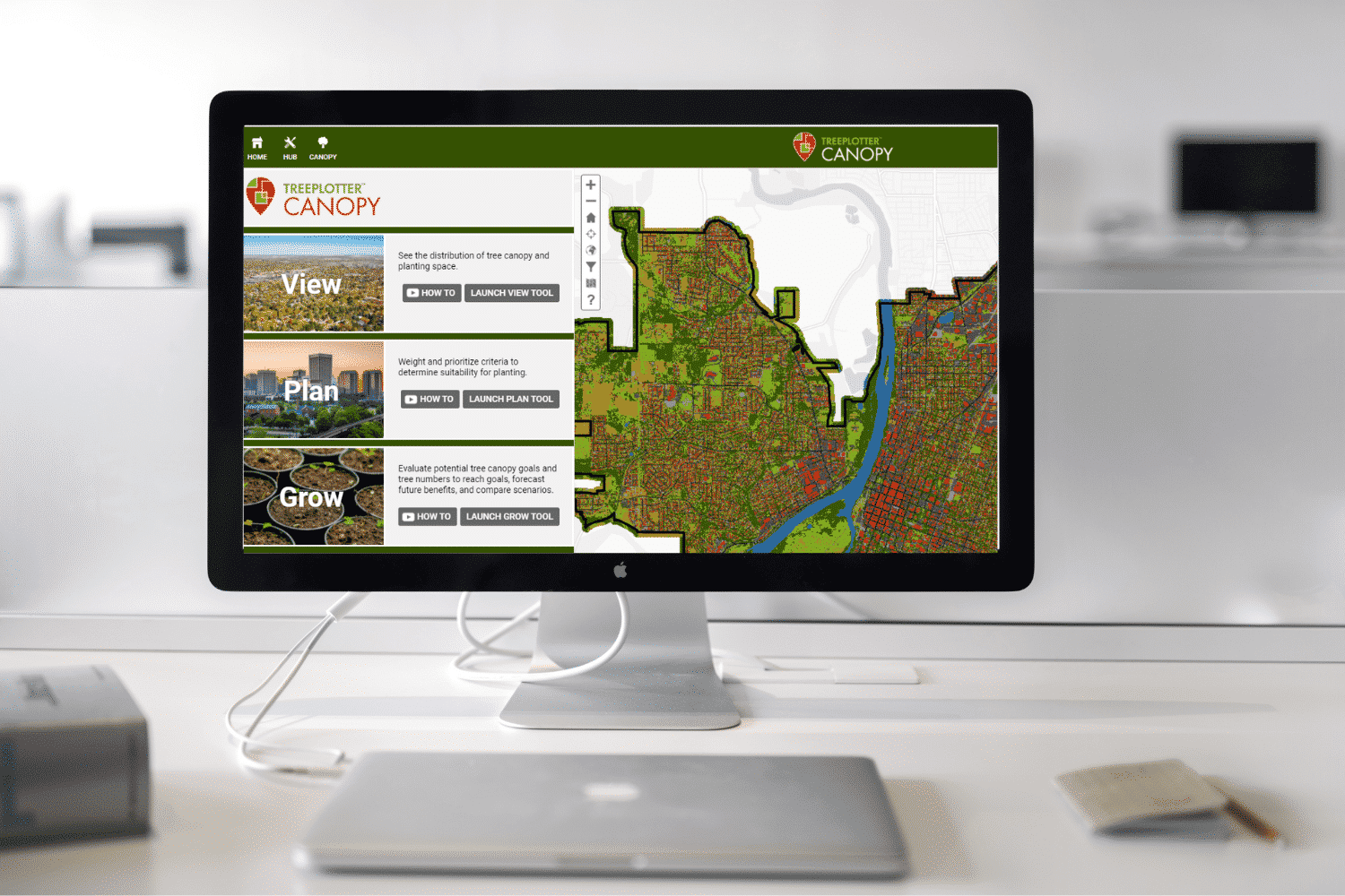
Our new subscription-based, artificial intelligence-driven tree canopy data is disrupting the traditional tree canopy mapping and assessment process that has been the status quo for over a decade. Naturally, that is generating some discussion around methods, accuracy, human intervention, and data ownership.
We’re glad to be a central figure in the conversation and at the leading edge of the industry. We’d like to further that discussion by exploring some of the recurring topics we are seeing come up around Urban Tree Canopy and Artificial Intelligence.
Personal Attention Where It Matters Most
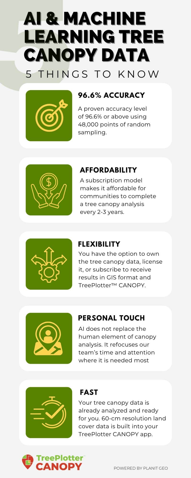
Our mission is to ensure every community has access to high quality, affordable tree canopy data and planning tools. At the core of this is our novel approach of using artificial intelligence (AI) and machine learning to develop high-resolution land cover data. Understandably, some have assumed that means a reduction in accuracy, with less hands-on involvement from GIS experts. Fortunately, that’s not the case. AI does not replace the human element of canopy analysis. It refocuses our team’s time and attention where it is needed most.
Analyzing tree canopy data used to require weeks of meticulous quality control by GIS technicians to reach a sufficient level of accuracy. Our new, nationally-available canopy data has the same level of accuracy or better, but is ready almost instantly. That means our GIS experts spend less time on data quality and assurance checks that can be subjective and potentially inconsistent and more time on data interpretation and analysis. The end product is a more insightful assessment that is ready faster, updated more frequently, more consistent from one year to the next, and costs less.
For example, we recently completed a tree canopy assessment for 32 Florida cities that were in the path of Hurricane Michael. Using traditional methods, the project budget would have only supported a basic change analysis. With the time and cost savings of AI-derived canopy data, our Geospatial Mapping team was able to do more analysis for more cities and build a detailed, interactive story map to share the results of their work.
Our data accuracy is still best in class, with a proven accuracy level of 96.6% or above using 48,000 points of random sampling.
Top Tier Accuracy, Just Like Before
Over the last few years, there has been an increase in companies offering tree canopy data, including some major tech players. Now that there are more sources for tree canopy data, accuracy is becoming a key differentiator between providers.
Though our methods are evolving, our data accuracy is still best in class, with a proven accuracy level of 96.6% or above using 48,000 points of random sampling. By using advanced machine learning algorithms instead of manual labor, more common errors are avoided.
Our subscription model makes it affordable for communities to complete a tree canopy analysis every 2-3 years, the frequency that new statewide aerial imagery becomes available, instead of the conventional 5-10 years. By using the exact same modern analysis methodologies year after year, there is also greater reliability when comparing canopy change from multiple time periods.
We are happy to show you the canopy data in your city so you can see for yourself. It’s part of our process. Please get in touch if you are interested in learning more.

Flexibility On Data Licensing and Ownership
We’re rethinking more than just how we analyze urban tree canopy data. We also give clients the option to own the tree canopy data, license it, or avoid that cost altogether and subscribe to receive derived results in GIS format and TreePlotter™ CANOPY software. Many clients don’t have the ability to manipulate land cover data in GIS software; what they benefit from the most is percent canopy, and percent change in canopy, for neighborhoods, land use types, or council districts.
If a community is interested in buying the land cover data though, we always provide that option. Data ownership has benefits such as sharing it with other city departments for further analysis like stormwater modeling. Land cover maps are also a nice visual in reports and engaging with the general public.
We feel strongly that we’re adapting to the needs of clients and providing the key results they need in an affordable way. We still offer traditional projects without licensing or subscriptions. Every client has the choice to buy and own the data we provide.
-Ian Hanou, PlanIT Geo, CEO and Founder
If a client discontinues their subscription, access to the GIS data and software is revoked, but they are able to keep any derived maps, spreadsheets, and reports. Another option is to display raster land cover data via web service. Rather than paying for the data, it can be hosted on our server and visually displayed in your GIS environment.
If you have additional questions on technology and tree canopy assessments, we would love to hear from you. You can also check out the articles, webinars, and blogs below for more detailed information about urban tree canopy and artificial intelligence.
Related Resources

Tree Canopy Data, Now and Why
Affordable and accurate accessibility to tree canopy data is easier and more affordable than ever. Watch this on-demand webinar with the Arbor Day Foundation, PlanIT Geo, and other partners to discuss different types of canopy data available for your city or town and what it can do to further your urban forestry program.
Get Your Urban Tree Canopy Assessment TOMORROW
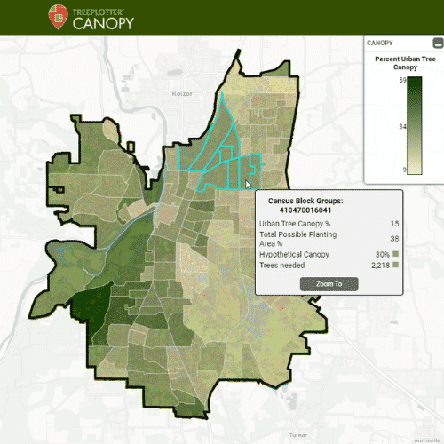
We are the first in our industry to provide 60-cm resolution land cover data built into an interactive tree canopy software tool, making it simple for you to view, plan and achieve your tree canopy goals. Off-the-shelf tree canopy analysis for the lower 48 is already completed.
The Importance of Monitoring Urban Tree Canopy
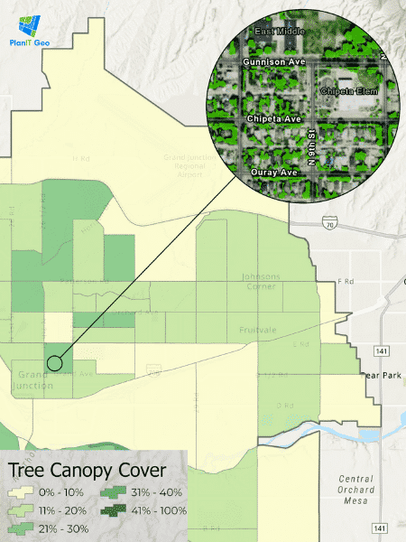
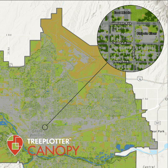
This infographic gives a quick shot into an effective urban forestry program in the small community of Grand Junction, Colorado. With their canopy data, the Grand Junction Forestry Division is educating leadership across city departments on the true value of tree canopy and the impacts of development, pests/diseases, and water conservation on canopy.
AI Driven Tree Canopy Analysis
Watch this on-demand webinar to learn more about AI-driven tree canopy analysis and how it is now incorporated into TreePlotter CANOPY software.
Stay Up To Date With The Latest News and Events
Join Our Community
Stay informed on the urban forestry industry with our monthly TREEbune newsletter, live webinars, and industry-specific content delivered to your inbox.
Urban Forestry Webinars
PlanIT Geo has a substantial on-demand webinar library. Get CEU credits, grow your knowledge base, and stay current on cutting edge industry technology.
Follow Us
We love to share industry-related news, software tutorials, blogs, and company news across our social channels.
Stay Up To Date With The Latest News and Events
Join Our Newsletter
Stay informed on the urban forestry industry with our monthly TREEbune newsletter, live webinars, and industry-specific content delivered to your inbox.
Urban Forestry Webinars
PlanIT Geo has a substantial on-demand webinar library. Get CEU credits, grow your knowledge base, and stay current on cutting edge industry technology.
Follow Us
We love to share industry-related news, software tutorials, blogs, and company news across our social channels.
