A New Tool For Equitable Urban Forest Planning
Canopy, Equity, and Tree Inventory Data Team Up in PlanIT Geo’s Latest Offering
June 17, 2024 | Alec Sabatini
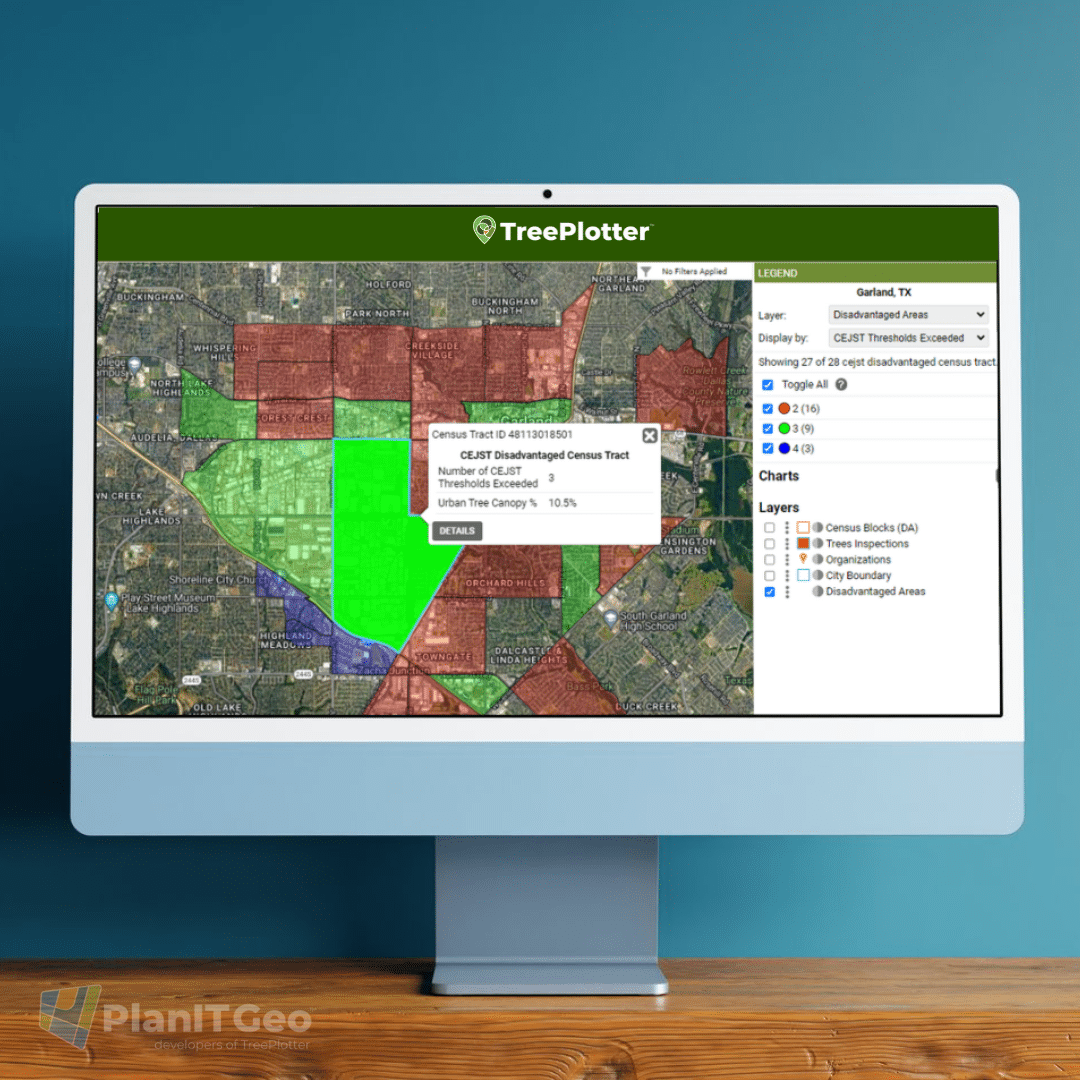
In 2023, the USDA Forest Service awarded $1 billion to nearly 400 projects to expand access to trees and green spaces in communities nationwide. Garland, Texas was one awardee, receiving $1 million to increase tree canopy in neighborhoods with minimal coverage.
The core objective of the IRA grants are to enhance urban forest benefits in underserved areas. Grantees, such as the City of Garland, must demonstrate that 100% of their project benefits go to disadvantaged communities.
This is an incredible opportunity, especially since IRA grants are available with no match requirements, but grant winners and future applicants must have a plan for tracking their efforts closely. To support this process, PlanIT Geo recently released the Land Cover and Tree Equity (LCTE) Data Pack, an add-on to TreePlotter™.
The LCTE Data Pack provides inventory and reference layers of disadvantaged communities and redlining areas combined with land cover statistics, all visualized within TreePlotter’s interface. With LCTE data you can prioritize projects at the census block scale by reviewing canopy coverage within disadvantaged areas.
Below we’ll explore how the LCTE Data Pack supports equitable urban forest project planning, with examples from the City of Garland.
What is the Land Cover and Tree Equity Data Pack?
To explain the LCTE data pack, we should first touch on the Climate and Economic Justice Screening Tool (CEJST). CEJST is the go-to tool for identifying disadvantaged communities that qualify for IRA grants. The tool uses 8 thresholds, such as legacy pollution, climate change, and health, to highlight overburdened and underserved census tracts nationwide. The data sets used by the CEJST tool include only one metric related to urban forestry, lack of greenspace, which measures the amount of impervious surface in the census tract. It’s a starting point, but it doesn’t offer much urban forest intel.
The LCTE data pack adds the urban forestry component with 8 defined land cover classes, including urban tree canopy. Communities can plan projects for maximum impact by displaying disadvantaged census tracts by existing tree canopy cover. Additionally, users can get a rough estimate of the available planting area by looking at how much area falls into the shrub, herbaceous, and soil land cover classes.
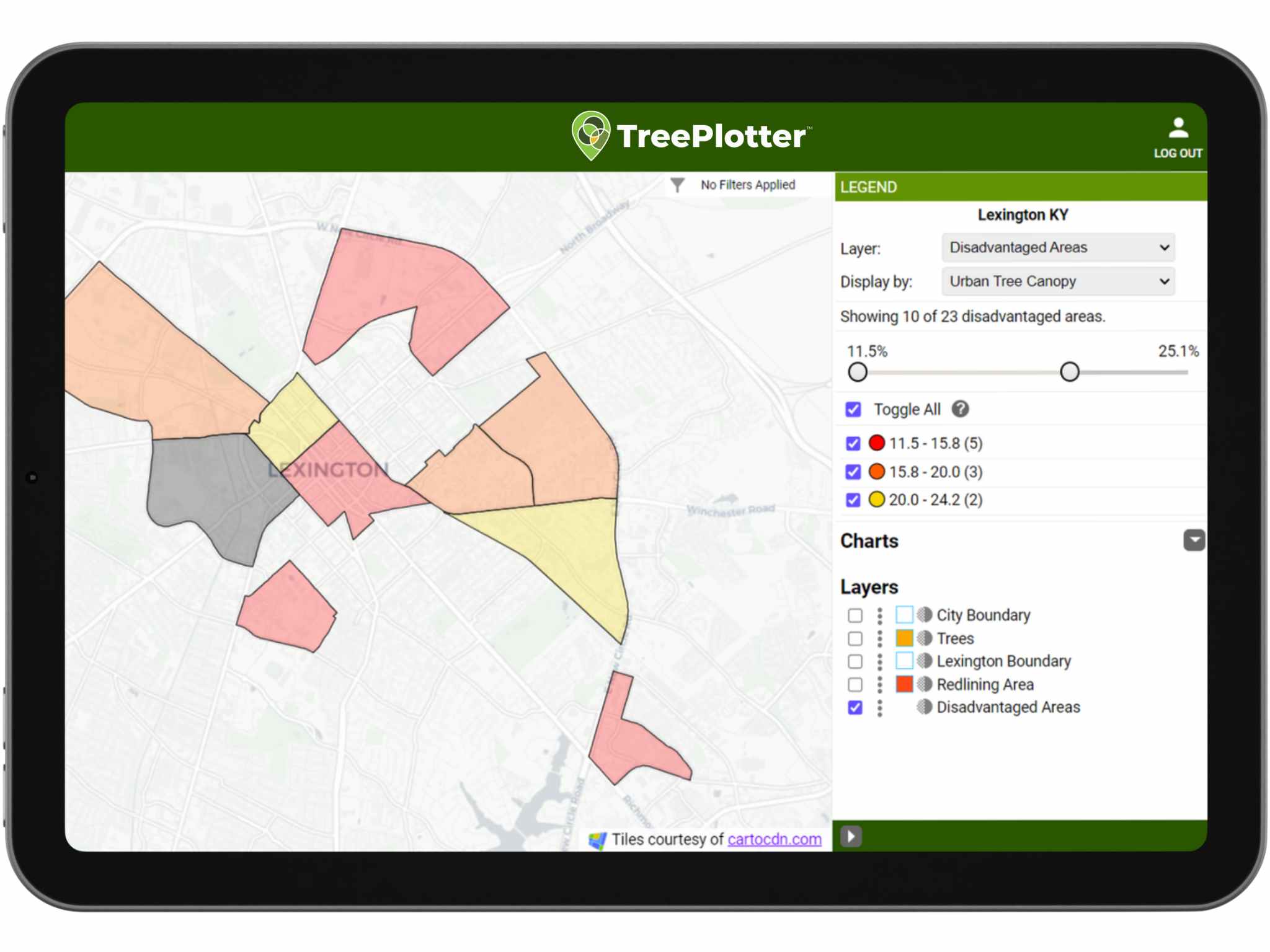
Above: Filtering for Disadvantaged Areas with below average Urban Tree Canopy.
The LCTE Data Pack includes:
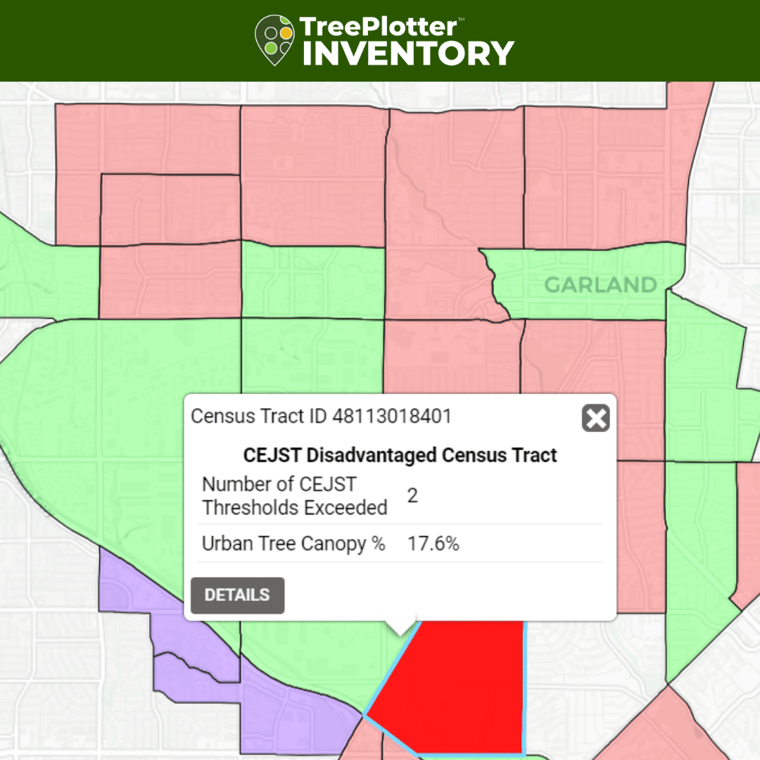
CEJST disadvantaged census tracts:
Each tract is encoded with all 8 CEJST disadvantage thresholds, canopy cover, and land cover classification percentages.
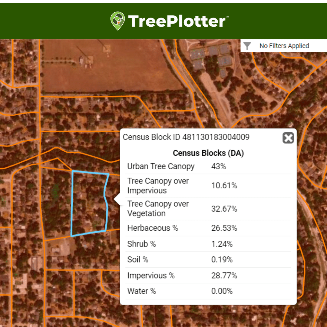
Census blocks within CEJST census tracts:
Each census block is encoded with high-level CEJST attributes, canopy cover, and land cover classification percentages.
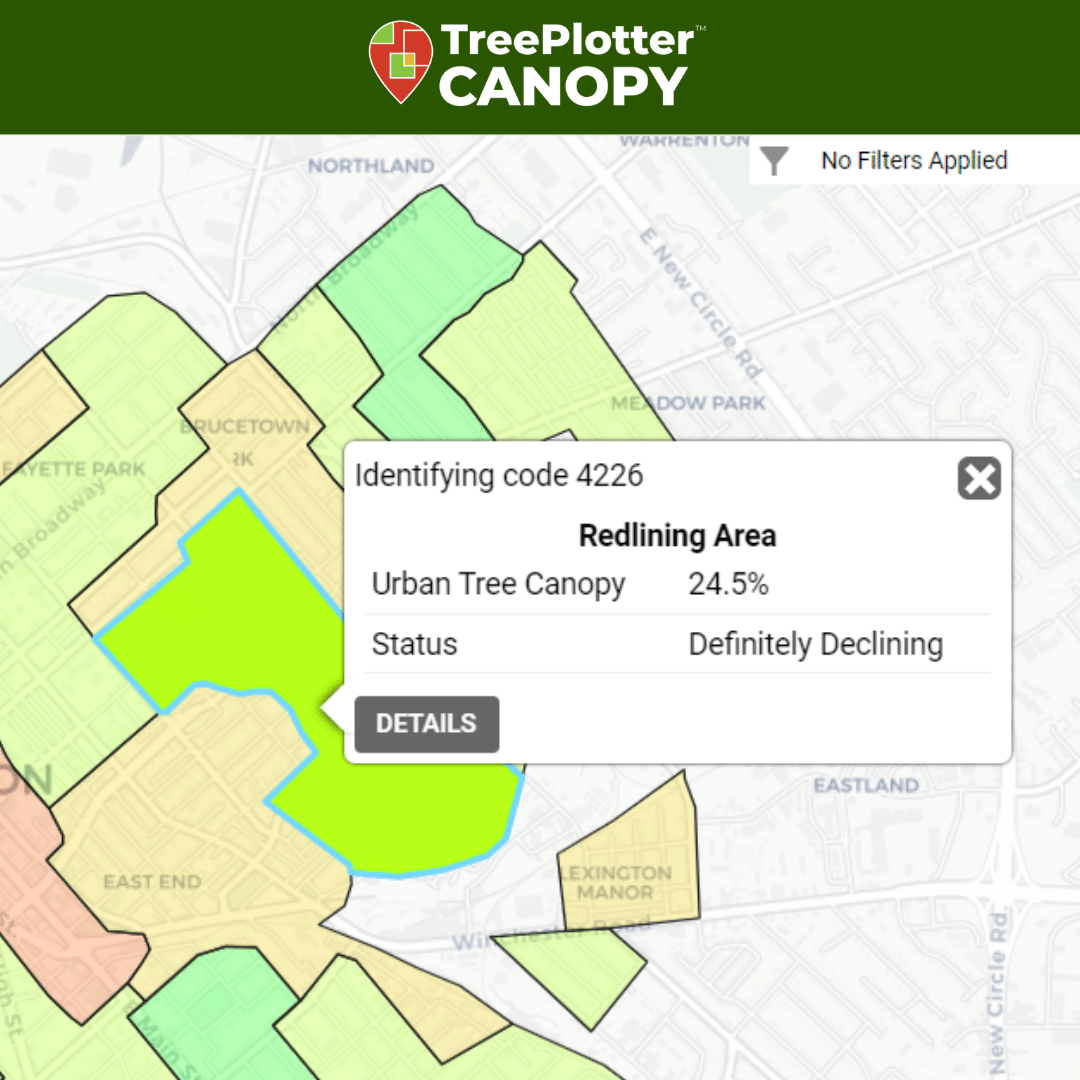
Historical redlining areas:
Each area is encoded with the redlining classification attribute, canopy cover, and land cover classification percentages. Redlining data is only available for select cities.
Garland’s Plans For Land Cover and Tree Equity Data
The City of Garland has two main goals for its Land Cover and Tree Equity data: tracking and storytelling.
As grant dollars are used to plant trees and conduct maintenance, all work will be tracked down to the census block to confirm everything is actually within CEJST disadvantaged areas. To do so, parks staff will plot points for new trees and update tree maintenance records into TreePlotter from the field.
This work tracking supports more than just grant reporting. City of Garland Parks Director, Matt Grubisich, also wants to better understand tree survivability. “We want to track where each tree goes and check its condition over five years to gauge which species thrive and better inform property owners about specific tree care plans.”
LCTE data will also support Garland in telling the story of how its $1 million grant translated directly into greater benefits for the neighborhoods in need.
I can pull up [within TreePlotter] how many trees we planted in each census block and calculate the ecosystem benefits. We can show these specific areas will increase canopy by X amount, have improved climate resilience, and show how those benefits create a return on investment
-Matt Grubisich, City of Garland Parks Director
A full, data-backed narrative will help Matt build buy-in so he can continue to raise money, and keep momentum going with future planting projects.
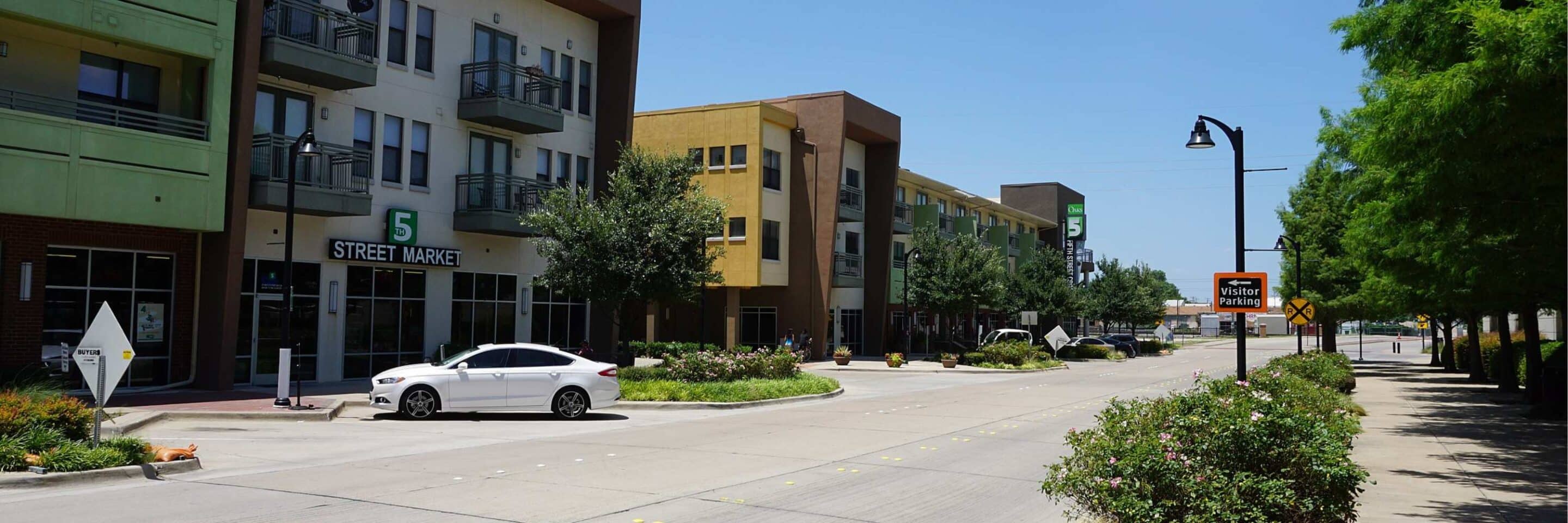
Canopy, Equity, and Tree Inventory Data Working Together
The Land Cover and Tree Equity Data Pack was designed to amplify and simplify equitable urban forest planning. Curious about this add-on? We’d be happy to have a conversation specific to your community. Please reach out with any questions here or contact your PlanIT Geo account representative.
Related Resources
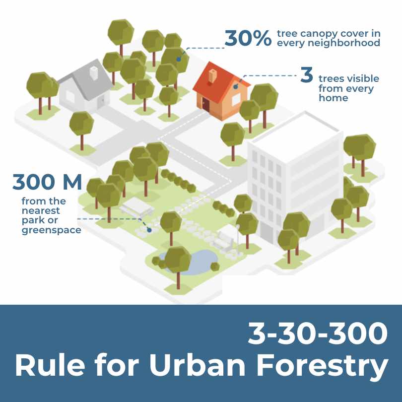
Urban Forestry’s New Benchmark: The 3-30-300 Rule
Unpacking the New Rule of Thumb for Urban Greening. In 2021 Cecil Konijnendijk, Director at the Nature Based Solutions Institute, proposed a new guideline for greener, healthier, more resilient cities: the 3-30-300 rule. The rule sets three minimum criteria for urban trees and green space.

Urban Forestry and Heat Mitigation 101: Free Guide
This guide covers opportunities at the intersection of urban forestry and heat mitigation, including the fundamentals of urban heat, methods to measure heat and tree canopy, and urban forest strategies for heat mitigation.
Tailoring TreePlotter to Meet Your Urban Greening Goals
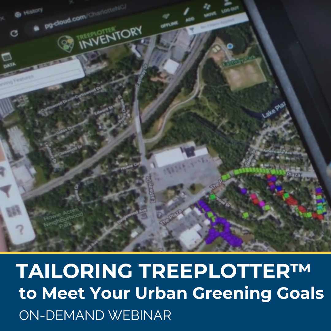
Software tools are designed for many but not all purchases are made for the same reasons, and TreePlotter users are no different. While many clients have similar needs and desires for their urban forestry program, we know there is not one way to reach those goals. Learn about real-life, unique case examples of how TreePlotter software is being used by clients around the United States to help map and manage urban forests and meet community greening goals.
Urban Forestry Grant Resources
Looking for urban forestry funding? You’ve come to the right place. Scroll down to look through our continuously updated list of urban forest grant opportunities, organized by region and state.
Stay Up To Date With The Latest News and Events
Join Our Community
Stay informed on the urban forestry industry with our monthly TREEbune newsletter, live webinars, and industry-specific content delivered to your inbox.
Urban Forestry Webinars
PlanIT Geo has a substantial on-demand webinar library. Get CEU credits, grow your knowledge base, and stay current on cutting edge industry technology.
Follow Us
We love to share industry-related news, software tutorials, blogs, and company news across our social channels.
Stay Up To Date With The Latest News and Events
Join Our Newsletter
Stay informed on the urban forestry industry with our monthly TREEbune newsletter, live webinars, and industry-specific content delivered to your inbox.
Urban Forestry Webinars
PlanIT Geo has a substantial on-demand webinar library. Get CEU credits, grow your knowledge base, and stay current on cutting edge industry technology.
Follow Us
We love to share industry-related news, software tutorials, blogs, and company news across our social channels.
