Urban Forestry’s New Benchmark: The 3+30+300 Rule
Unpacking the New Rule of Thumb for Urban Greening
April 22, 2024 | Alec Sabatini
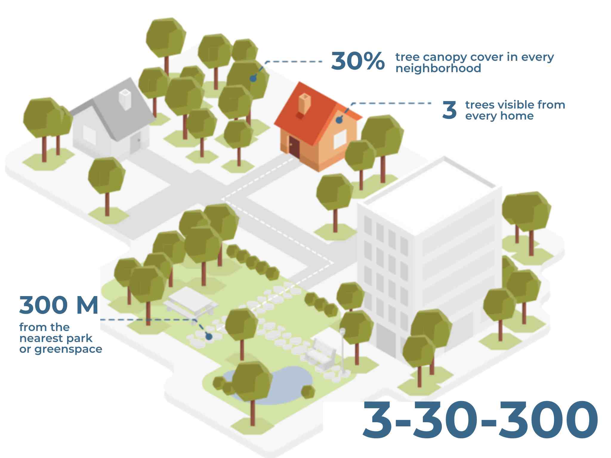
In 2021 Cecil Konijnendijk, Director at the Nature Based Solutions Institute, proposed a new guideline for greener, healthier, more resilient cities: the 3+30+300 rule. The rule sets three minimum criteria for urban trees and green space:
-
At least 3 trees in sight from every home, school, and workplace
-
At least 30% tree canopy in every neighborhood
-
No more than 300 meters between every home and the nearest park or green space
The 3+30+300 Rule
Evidence-based guidelines are a proven strategy for motivating decision-makers, planners, developers, and residents. All over the world, tree canopy goals have helped energize cities into action by distilling the complexities of their urban forest into a single target.
The 3+30+300 rule takes a similar approach but goes a few steps further by including components for green space visibility and accessibility. All three components offer vital contributions to our health and well-being. The objective of this rule was to strike a careful balance between being comprehensive, straightforward to implement and monitor, and easy to remember.
Below we’ll break down each piece of the rule and how cities can measure how well they meet the requirements. You can also watch the on-demand webinar: Mapping the 3+30+300 Rule for Actionable City Greening. Cecil and Joost Verhagen, whose team at Cobra Groenzicht is pioneering methods of mapping the rule, will discuss 3+30+300 and share visualizations of real-world scenarios.
3 Types of Nature Exposure
The rule covers three types of nature exposure: the ability to see urban nature from the windows of your home and workplace, living among trees and vegetation in your neighborhood, and accessing a park or green space for recreational purposes. Studies have shown that each type of nature exposure creates varied, positive health impacts.
3 Trees
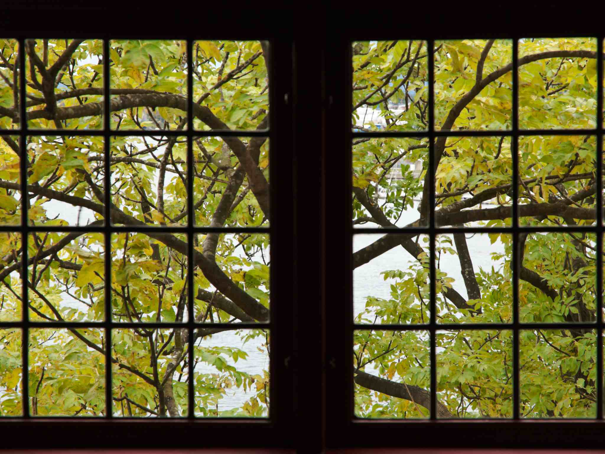
Three visible trees are a proxy indicator for ensuring residents have a certain amount of visible green space. Views of natural vegetation have been shown to help with stress recovery, long-term improvements in people’s well-being, enhanced job performance, and more. The number ‘3 visible trees ’ is not specifically supported by scientific evidence but was chosen to strengthen the rule’s stickiness when combined with 30% and 300 meters.
30% Canopy
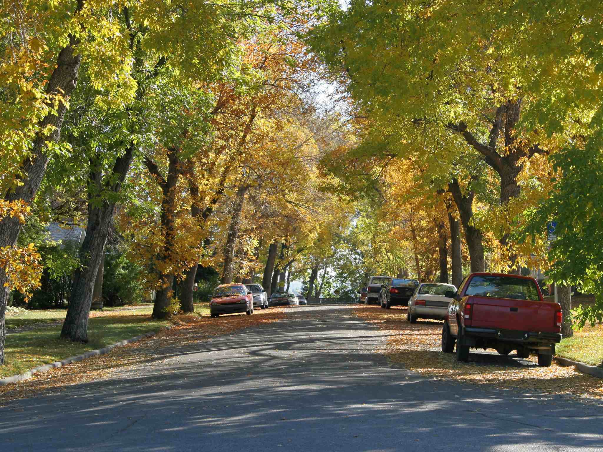
Tree canopy coverage is connected with a host of positive associations, such as reducing extreme urban heat, lower all-cause mortality, and improved childhood development. 30% urban tree canopy coverage has been found to be an important threshold for positive health effects. Around the world, from Barcelona to Seattle to Canberra, cities have set 30% canopy goals. The rule specifies that 30% canopy should be achieved at the neighborhood level, not a citywide average, to ensure lush, affluent areas don’t overshadow sparsely treed, disadvantaged neighborhoods.
300 Meters
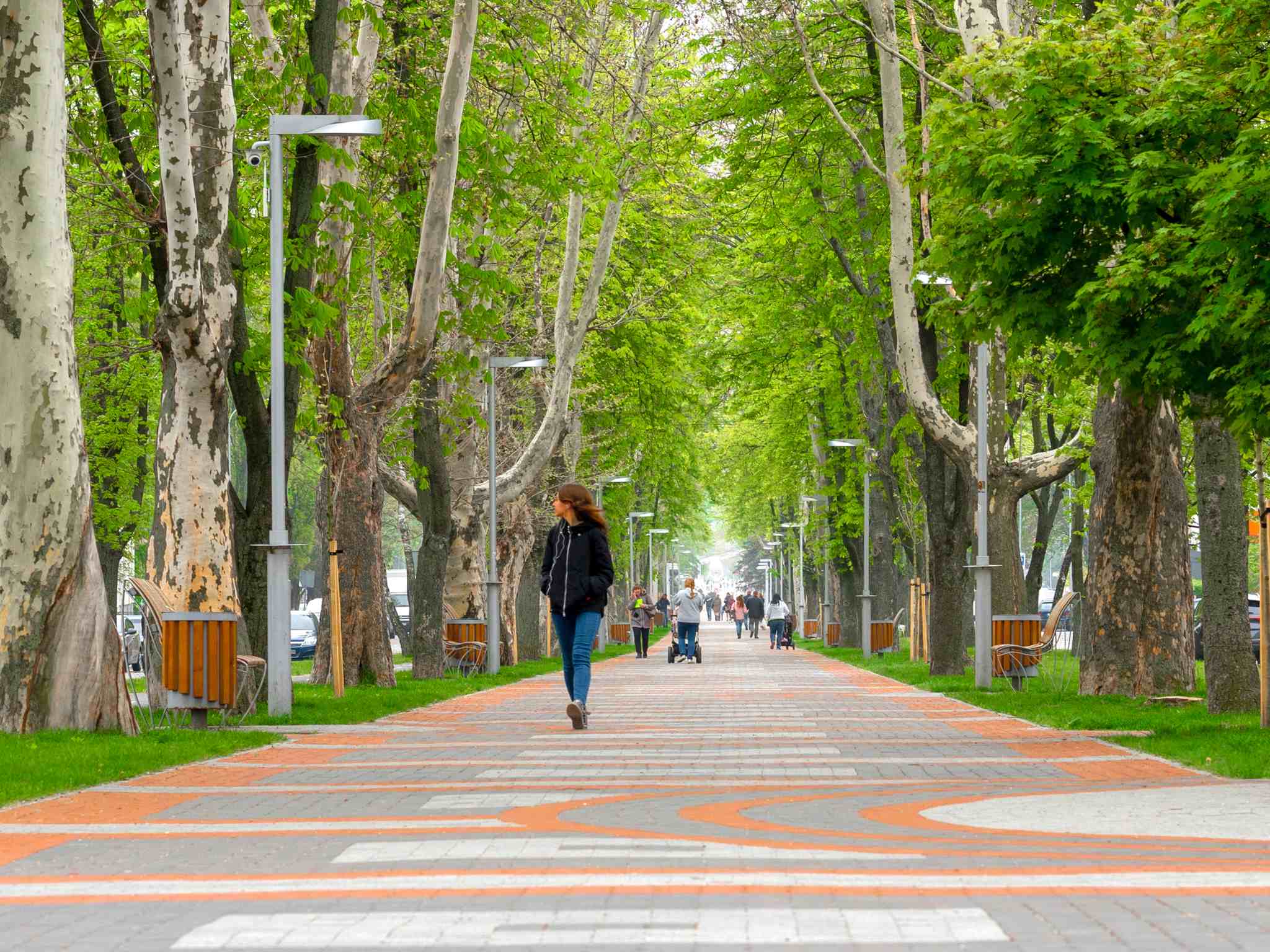
Proximity to green space creates a range of social and health impacts, such as preventing cardiovascular morbidity and diabetes. This rule aligns with the recommendation of the World Health Organization that residents should have access to a public green space of at least one hectare within 300m from their homes, roughly a 5-minute walk away. Though the rule doesn’t include standards for the size or quality of the green space, that is a metric communities should consider. For example, a small neighborhood green space can be within easy reach, while a larger natural area can be further away, but each offers essential benefits.
How To Measure the 3+30+300 Rule
Measurement is what gives a benchmark traction. The efficacy of the 3+30+300 rule is linked to how effectively it can be measured. Once quantified, a community has a baseline by which they can set goals and track progress.
This three-pronged rule requires multiple measurement strategies. A 2023 study identified seven main measurement options: vegetation indices, street-level analyses, tree inventories, questionnaires, window view analyses, land cover maps, and urban green space property maps.
Land cover maps and geospatial analysis are well-established, accessible methods for calculating urban tree canopy. Measuring the nearest public green space can be accomplished using similar tools, though there are ways to add additional detail for greater accuracy. A straightforward analysis looks at the direct distance, i.e. “as the crow flies”. A more sophisticated calculation would factor in access points, crosswalks, and physical barriers.
“3 visible trees” is the trickiest component to measure. One route is to use a community science approach. Distribute surveys to a representative sample of people per neighborhood and ask them to report the number of trees they can see. They could also submit photos looking through their most viewed windows to be analyzed for trees. The benefit of the community science approach is it promotes citizen engagement and awareness of urban forestry efforts.
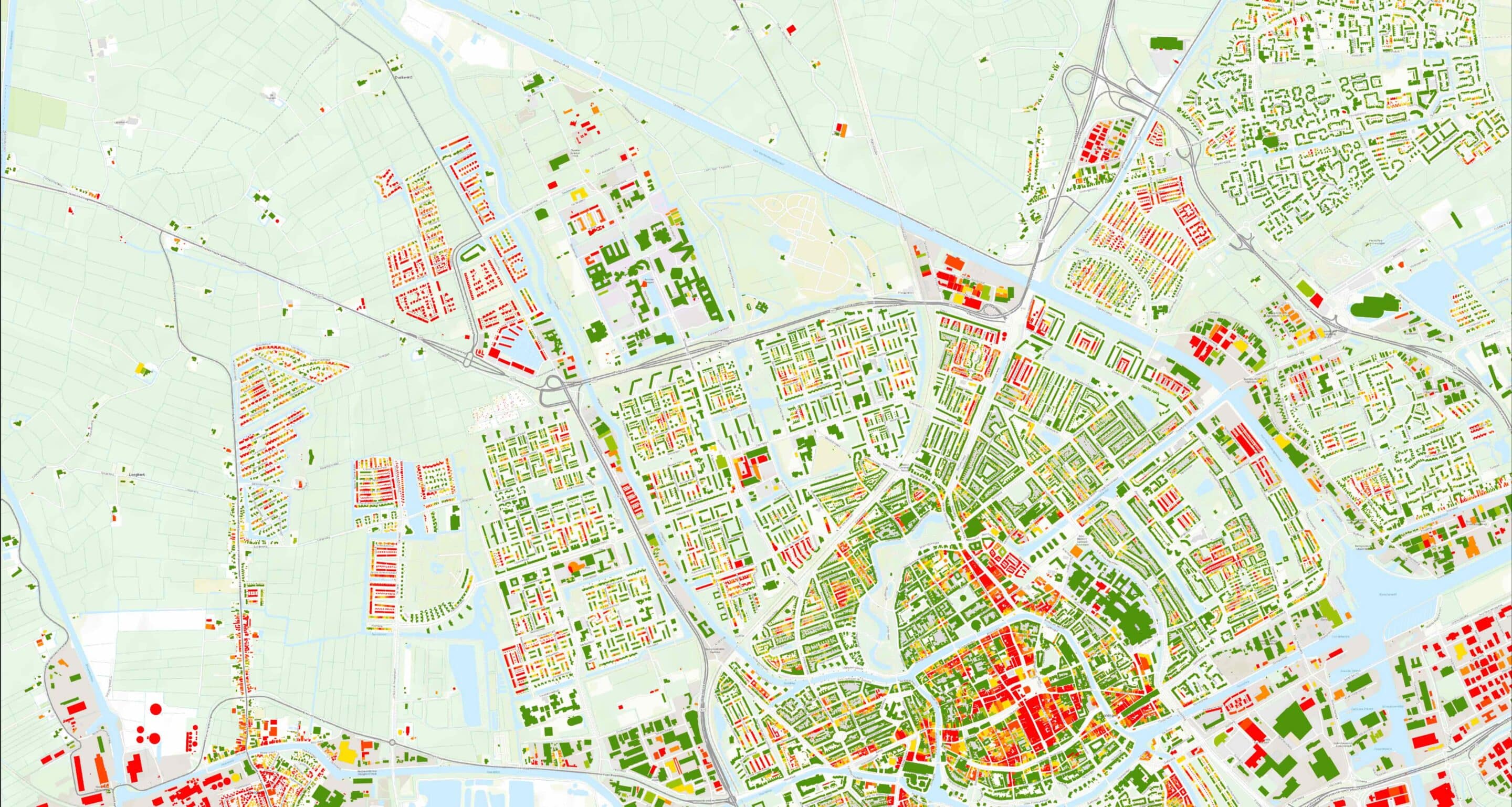
There’s also a geospatial option. Cobra Groeninzicht, in the Netherlands, uses a buffer area of 30m around buildings to determine the visible tree component. Their methodology, as well as how Dutch cities are putting the 3-30-300 data to work, was covered in the on-demand webinar: Mapping the 3+30+300 Rule for Actionable City Greening.
At Right: Geospatial analysis of 3 visible trees from Cobra Groeninzicht.
Building Momentum
The 3+30+300 rule has been gathering steam since its 2021 launch. The United Nations Economic Commission for Europe included the rule in a policy brief, and it’s making its way into municipal policies, such as the city masterplan of Malmo, Sweden.
Adoption of the 3+30+300 rule will accelerate once measurement strategies become standardized. The data sets from Cobra Groenzicht and the planned inclusion of the data in TreePlotter™ software will help propel the rule to a broader audience.
Cities may have a long road to meeting all three criteria. A study found only 4.7% of people in Barcelona met a surrogate version of the 3+30+300 rule. Even as a hard-to-reach target, there is immense value in getting cities to recognize the multiple aspects of urban forests needed to boost health and resilience, and to start moving in the right direction.
Related Resources
URBAN FORESTRY AROUND THE GLOBE
ON DEMAND WEBINAR:
There are challenges to managing a healthy urban forest that are shared around the world, including pests, storm damage, and development. This webinar brings together different perspectives to compare how unique objectives, methods, and technology are employed around the world to tackle urban forestry’s biggest challenges.
In the Urban Forestry Around the Globe webinar Ian Hanou and Russell Horsey hosted two highly respected urban forestry professionals, David Sivyer, Program Manager at the US Forest Service, and Cecil Konijnendijk, co-founder of Nature Based Solutions Institute and Global Urban Forester, to discuss urban forest management in their regions and compare with others around the world.
CREATING THE RIGHT CHANGE WITH URBAN FORESTRY FUNDING
Jad Daley, President of American Forests, joined Dr. Nadina Galle to talk about the urban forestry funding paradigm shift in U.S. urban forestry. Their discussion covered the cause of the funding windfall and what it could and should look like to use these dollars to rebalance systemic inequities.
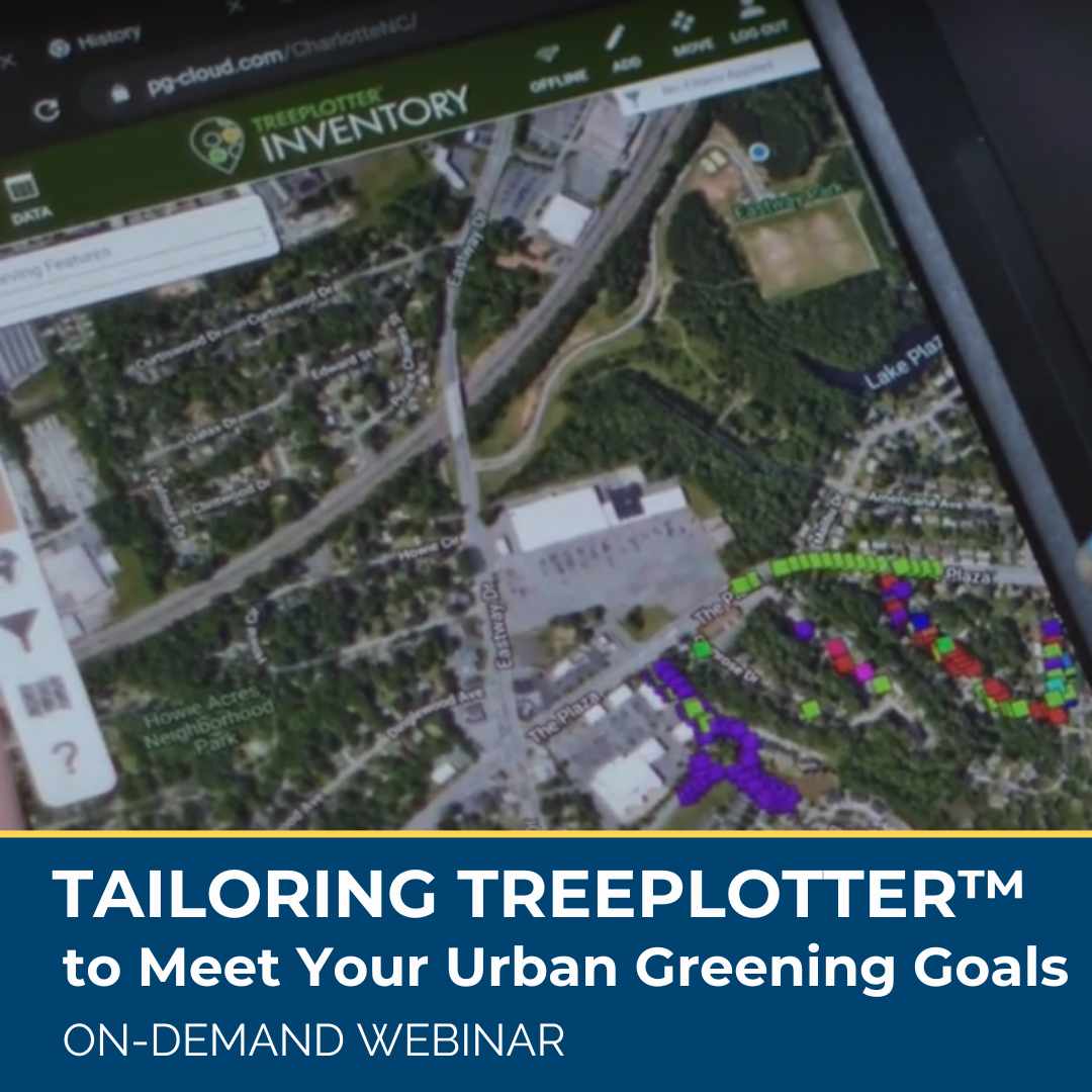
TAILORING TREEPLOTTER TO MEET YOUR URBAN GREENING GOALS
ON DEMAND WEBINAR: Software tools are designed for many but not all purchases are made for the same reasons, and TreePlotter users are no different. While many clients have similar needs and desires for their urban forestry program, we know there is not one way to reach those goals. Learn about real-life, unique case examples of how TreePlotter software is being used by clients around the United States to help map and manage urban forests and meet community greening goals.
TIPS FOR PLANNING AN URBAN TREE INVENTORY AND GETTING THE MOST OUT OF IT
Urban tree inventories are a way for forest managers to know exactly what they are working with and how to prioritize their maintenance efforts for maximum effect.The key to maintaining a sustainable and healthy urban forest is species and age diversity, proper tree maintenance, risk management, and community support. Urban tree inventories are useful for any public department, nonprofit, or company that manages a multitude of trees, including cities, counties, as well as corporate and university campuses.
Stay Up To Date With The Latest News and Events
Join Our Community
Stay informed on the urban forestry industry with our monthly TREEbune newsletter, live webinars, and industry-specific content delivered to your inbox.
Urban Forestry Webinars
PlanIT Geo has a substantial on-demand webinar library. Get CEU credits, grow your knowledge base, and stay current on cutting edge industry technology.
Follow Us
We love to share industry-related news, software tutorials, blogs, and company news across our social channels.
Stay Up To Date With The Latest News and Events
Join Our Newsletter
Stay informed on the urban forestry industry with our monthly TREEbune newsletter, live webinars, and industry-specific content delivered to your inbox.
Urban Forestry Webinars
PlanIT Geo has a substantial on-demand webinar library. Get CEU credits, grow your knowledge base, and stay current on cutting edge industry technology.
Follow Us
We love to share industry-related news, software tutorials, blogs, and company news across our social channels.
