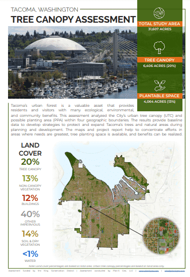
Urban Tree Canopy Assessment: Project Summary
Tacoma, WA, USATacoma’s urban forest is a valuable asset that provides residents and visitors with many ecological, environmental, and community benefits. This assessment analyzed the City’s urban tree canopy (UTC) and possible planting area (PPA) within four geographic boundaries. The results provide baseline data to develop strategies to protect and expand Tacoma’s trees and natural areas during planning and development. The maps and project report help to concentrate efforts in areas where needs are greatest, tree planting space is available, and benefits can be realized.
Key Insights
Total Study Area Acres
Acres of Plantable Space
Tree Canopy 2017
Tree canopy data were analyzed for Tacoma’s land use categories to determine the distribution of existing and potential urban tree canopy throughout the city. Parks and Open Space areas had the highest UTC at 56% and contributed 44% of the City’s total canopy. Single-Family Residential areas contributed 39% of total canopy as well as 57% of all plantable space

