We’ve already analyzed your city’s tree canopy
Buy it today, get it tomorrow.
Urban tree canopy assessments should be easy and affordable so you can spend more time on planning, management, operations, and community engagement. That’s why we partnered with EarthDefine, analyzed high-resolution land cover across the country, and deliver data and software in days, not months. Get a pulse on your canopy through one of our annual subscription plans.
Now that’s data-driven urban forestry.
Easy to Buy
Off the Shelf Analysis
Simple to Use
Fast and Updated
Effortless Sharing
Equity and Benefits

Get Your Tree Canopy data now
We already did this work so you can stay focused on yours
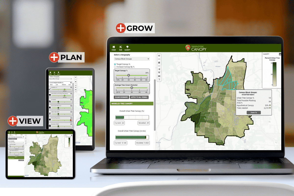
We have reduced your technical hurdles, there is no need for GIS staff to analyze or scope out a tree canopy study. With an annual subscription, we’re bringing the data to you, preprocessed off-the-shelf, at the same high resolution and accuracy, and updated every two years on average.
You will always have accurate canopy data. Flatlining your budget and incorporating tree canopy data into your overall urban forest management is now available immediately and all you need to do is VIEW, PLAN and GROW your urban forest.
Get Your Tree Canopy data now
We already did this work so you can stay focused on yours
We have reduced your technical hurdles, there is no need for GIS staff to analyze or scope out a tree canopy study. With an annual subscription, we’re bringing the data to you, preprocessed off-the-shelf, at the same high resolution and accuracy, and updated every two years on average. You will always have accurate canopy data. Flatlining your budget and incorporating tree canopy data into your overall urban forest management is now available immediately and all you need to do is VIEW, PLAN and GROW your urban forest.
Better Your Technology.
Better Your Forest.
Canopy Software and EarthDefine Data
Rapid, high resolution, accurate, and frequently updated urban tree canopy assessment data and interactive online maps. EarthDefine uses Artificial Intelligence and Machine Learning to transform earth sensor data into consumable geospatial information products. A reliable low-cost subscription model provides the data cities need to monitor the urban forest.

EarthDefine creates the most detailed and up-to-date tree canopy data for the US. With 60-cm resolution, your data accurately captures individual trees and small gaps in the urban forest. The data is reassessed annually to capture tree cover change.
60-cm
96.6%
97.3%
TreePlotter CANOPY
Ready to get the big-picture view of your urban forest? TreePlotter CANOPY has three product levels and a wide variety of add-on functionalities to create the perfect software fit for your organization.
All prices listed are US. Please contact us for international pricing.
Base

Most Used By
Small University Campus
Small NPO
Small Municipality
Talk With Sales for International Pricing
Includes ONBOARDING and SOFTWARE SUPPORT
Complete

Most Used By
Large municipality
Large corporate campus
Housing Authority
Parks District
Talk With Sales for International Pricing
Includes ONBOARDING and SOFTWARE SUPPORT
Custom

Most Used By
Large municipality
Large corporate campus
State Agency
Housing Authority
Parks District
Talk With Sales for International Pricing
Includes ONBOARDING and SOFTWARE SUPPORT
A Few of our Satisfied Clients
Support Resources
Webinar
Demo App
Article
Editorial
Get a personalized walkthrough of TreePlotter™ CANOPY software.
About PlanIT Geo™
At PlanIT Geo, you’ll find a team driven by trees and technology. We are innovators and your partner in community forestry.
We are passionate about the work we do and derive purpose from helping others map and understand the value of nature-based solutions for a greener future.
TreePlotter Support
Current clients can visit our support site to get updates, feature releases, and answers to many commonly asked questions.
TreePlotter Support Website
Contact
PO Box 1334, Wheat Ridge, CO 80034
Sales & Support: 833-873-3627
U.K. Contact
U.K. Sales: 07906625472
U.K. Support: 03330 509905
TreePlotter UK Website
Follow Us
Join Our Community
