Smarter Greenspace Management: How TreePlotter Transforms Urban Forestry
Driving Efficiency, Transparency, and Community Trust Through Digital Greenspace Management Solutions

Urban forestry and green infrastructure managers face mounting challenges in greenspace management: large and aging tree populations, increasingly complex compliance needs, rising public expectations, and the ever-present constraint of limited resources. Harnessing technology, specifically, a scalable and user-friendly solution like TreePlotter, can be a game changer for organizations seeking sustainable, customer-focused results. For a wider industry view, check out the U.S. Forest Service’s guidance on urban forestry management data.
Understanding Real-World Challenges in Greenspace Management
Many housing providers, municipalities, and contractors start out managing tree inventories and green assets using outdated methods: clipboards, paper checklists, annotated spreadsheets, and disparate photo archives. Such fragmented approaches hinder efficiency, increase administrative burden, and make compliance and public transparency more difficult.
Institutions like Onward, a large social housing provider in the UK, once relied on weekly paperwork, manual signoffs, and siloed Excel files to track everything from van inspections to communal tree surveys. This process was cumbersome and made it nearly impossible to report, analyze patterns, or respond nimbly to resident questions and regulatory requirements.

Implementing TreePlotter: Laying the Digital Foundation
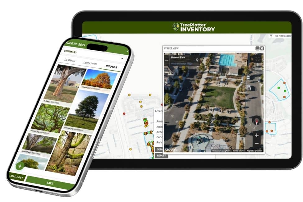
TreePlotter provides a cloud-based, interactive platform for mapping, managing, and analyzing all aspects of greenspace—including individual trees, land polygons, parks facilities, and work records. Its modular design enables organizations to tailor the system to their needs, whether tracking risk assessments, managing large-scale compliance cycles, or creating work orders for in-house and contractor teams.
Key steps in implementation include:
- Comprehensive mapping of all land assets, trees, and infrastructure
- Setting up automated workflows for daily vehicle checks, grounds maintenance, and compliance inspections
- Migrating legacy data and photos, where feasible, and standardizing field protocols for consistent data quality
- Introducing mobile and web interfaces so staff can collect or access information on any device—regardless of location or technical skill level
Land & Tree Mapping: Enabling Transparency and Accountability
Organizations managing thousands of properties and tens of thousands of trees benefit from geospatial tools that outline exactly what assets are where, who is responsible for them, and when maintenance or inspection was last completed. TreePlotter CANOPY and mapping layers let teams visualize trees, play parks, hedges, and hardstandings, making scheduled work clear and defensible. See how these tools are applied in real programs through case studies from Oxfordshire County Council and other clients.
Supervisors and contractors can pull up detailed records—including photos, inspection intervals, risk ratings, and even regulatory preservation zone data—in real-time. If a resident queries the status of a tree, staff can show precise documentation of inspection and work history, strengthening trust and speeding resolution.
“This system enables us to manage, cradle to grave on any job—we’ve got reports, we’ve got visuals, we can use it across teams. Anyone can use it. We’re not restricted by licensing… For us, visibility for everybody is a huge win. It also means we can justify, basically, on costs, on schedules, on tree management. It’s really, really worthwhile doing.
-Lynne Coyle, Bronwood Homes, UK
Transforming Workflows: Going From Paper to Real-Time Digital
Adopting TreePlotter replaces laborious paper and spreadsheet systems with automated, filterable digital workflows. Daily van inspections, for example, become a matter of completing a standardized digital checklist on a phone or tablet, streamlining compliance and saving supervisor time. Grounds maintenance and tree teams document their activities through geotagged before-and-after photos, feeding directly into management dashboards and public-facing portals.
This digital transition not only improves organizational efficiency but dramatically reduces the chances of errors or loss of key compliance data—a critical factor in risk management and cost control.
Enhancing Engagement, Compliance, and Service
TreePlotter doesn’t just support internal operations—it powers engagement with customers and stakeholders. With customizable portals, organizations can choose exactly what to share with residents, from schedules for tree inspections and grass cutting to evidence-based responses for complaints or requests. The system tailors the depth of information to the needs of different audiences, bolstering both compliance and customer satisfaction. Gain an independent perspective on public and stakeholder engagement from Canopy’s explanation of TreePlotter’s benefits.
Moreover, regulatory obligations such as protection of nesting birds or chemical application logs are easily tracked and audited within the system, allowing organizations to demonstrate diligence and best practices.
Transitioning staff—regardless of prior technology experience—is crucial for success. Organizations have found that TreePlotter’s intuitive design and strong support materials (such as tutorials and pictorial guides) make it accessible, even for those who have never used a smartphone for work. One-to-one and small group training, peer support, and ongoing team check-ins help ensure everyone can adopt new workflows confidently and competently.

Delivering Tangible Benefits: Customer Satisfaction and Strategic Flexibility
The impact of digitized greenspace management is both immediate and durable:
- Substantial administrative time savings and reduced paperwork
- Stronger compliance with health, safety, and regulatory standards
- More informed and transparent communication with stakeholders and customers
- Flexibility to adapt the platform for emerging needs such as biodiversity net gain, environmental reporting, or future procurement cycles
Clients report not only improved operational performance, but also increases in customer satisfaction scores—thanks to clear evidence and proactive communications enabled by TreePlotter.
Lessons Learned and Looking Ahead
The shift to TreePlotter is about more than adopting new software: it is a long-term investment in organizational resilience, transparency, and community trust in urban forestry programs. Standardized, real-time data allows teams to justify decisions, demonstrate impact, and plan effectively for both day-to-day and strategic goals. For an academic analysis and recommendations, see UCSB’s review on urban forestry practices and management plans.
Crucially, clients emphasize the importance of ongoing support, frequent feedback loops, and willingness to iterate processes for maximizing value over time. As public expectations rise and regulations evolve across the globe, TreePlotter stands out as a genuine partner for urban forestry—helping cities, housing providers, and agencies deliver healthier, greener, more sustainable places for all.
If you would like to learn more about tailoring TreePlotter’s suite for your specific needs or to see live demonstrations, we welcome discussions from urban forestry professionals around the world.
Related Resources
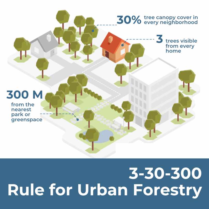
Urban Forestry’s New Benchmark: The 3-30-300 Rule
Unpacking the New Rule of Thumb for Urban Greening. In 2021 Cecil Konijnendijk, Director at the Nature Based Solutions Institute, proposed a new guideline for greener, healthier, more resilient cities: the 3-30-300 rule. The rule sets three minimum criteria for urban trees and green space.

Urban Forestry and Heat Mitigation 101: Free Guide
This guide covers opportunities at the intersection of urban forestry and heat mitigation, including the fundamentals of urban heat, methods to measure heat and tree canopy, and urban forest strategies for heat mitigation.
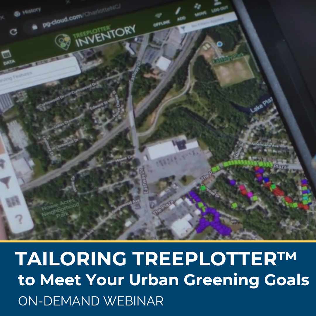
Tailoring TreePlotter to Meet Your Urban Greening Goals
Software tools are designed for many but not all purchases are made for the same reasons, and TreePlotter users are no different. While many clients have similar needs and desires for their urban forestry program, we know there is not one way to reach those goals. Learn about real-life, unique case examples of how TreePlotter software is being used by clients around the United States to help map and manage urban forests and meet community greening goals.
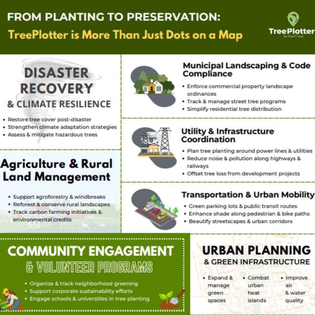
From Planting to Preservation – More Than Just Dots on a Map
TreePlotter empowers organizations to manage green projects across urban planning, landscaping, utilities, community engagement, disaster recovery, and more, making it easier to track environmental impacts, ensure regulatory compliance, and secure project funding, all while supporting sustainability and smart city initiatives.
Stay Up To Date With The Latest News and Events
Join Our Community
Stay informed on the urban forestry industry with our monthly TREEbune newsletter, live webinars, and industry-specific content delivered to your inbox.
Urban Forestry Webinars
PlanIT Geo has a substantial on-demand webinar library. Get CEU credits, grow your knowledge base, and stay current on cutting edge industry technology.
Follow Us
We love to share industry-related news, software tutorials, blogs, and company news across our social channels.
Stay Up To Date With The Latest News and Events
Join Our Newsletter
Stay informed on the urban forestry industry with our monthly TREEbune newsletter, live webinars, and industry-specific content delivered to your inbox.
Urban Forestry Webinars
PlanIT Geo has a substantial on-demand webinar library. Get CEU credits, grow your knowledge base, and stay current on cutting edge industry technology.
Follow Us
We love to share industry-related news, software tutorials, blogs, and company news across our social channels.
