Stoke The Public’s Tree Curiosity With A Community Engagement Map
Learn more about the newest feature in the TreePlotter™ software suite.
September 1, 2021 | Alec Sabatini

It’s not enough to just have a webpage though. There is a high bar for capturing and holding anyone’s attention online. Information on the internet needs to be easily accessible, intuitive, and interesting. The best way to meet those requirements for urban forestry is through an interactive, online tree map. These tools give residents a navigable, visual display of where trees are in their community and at the click of a button they can access information like species, size, and eco-benefits for the whole forest or on an individual tree basis.
And why is that important? Well, advocacy starts with education. Interactive tree maps are a potent method for building public awareness and by extension, public support for urban forestry programs.
To meet this modern need, we built a new core feature called the Community Engagement Map. The Community Engagement Map (CEM) provides clients with a simple, public-friendly version of their TreePlotter™ INVENTORY application that can be accessed as an embedded map on a live webpage or as a stand-alone website. The more the community engages with the map, the more the appreciation and recognition of your urban forestry programs will grow.
What can the Community Engagement Map show?
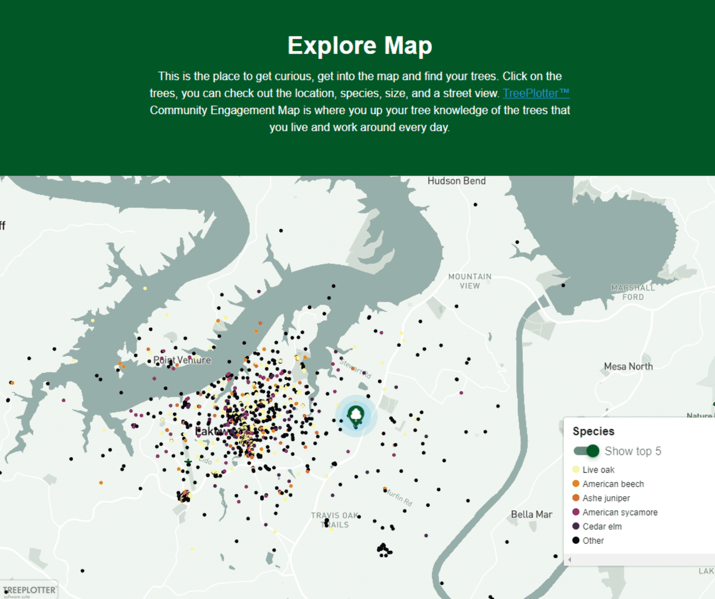
Tree Map
Display all trees or a subset of trees from your TreePlotter INVENTORY application. Users can colorize map based on different data fields, such as species, land use, diameter at breast height (DBH), or condition. The eco-benefits created by the entire urban forest, broken down by type, are also displayed.
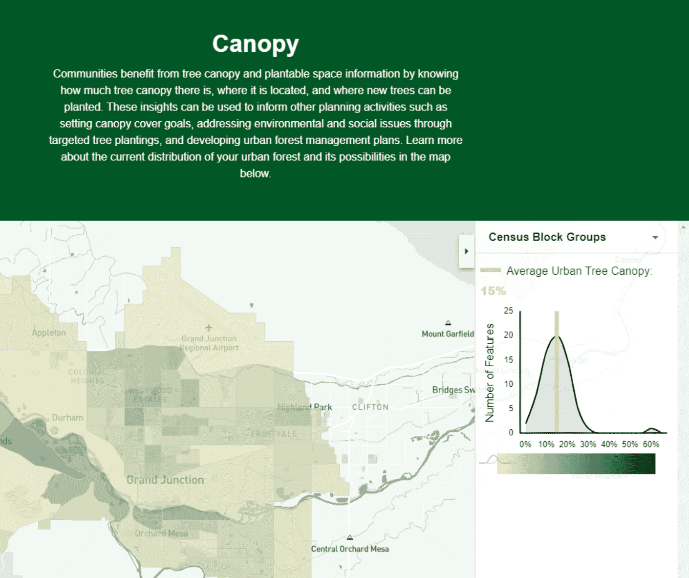
Canopy Map
Instead of displaying individual tree points, a canopy map visualizes how tree canopy is distributed throughout your community. The map can be toggled to look at different scales, such as census blocks, watersheds, or council districts. If your community does not have urban tree canopy data, you’re in the right place. Learn about our canopy data subscriptions here, or contact us about a custom urban canopy assessment project.
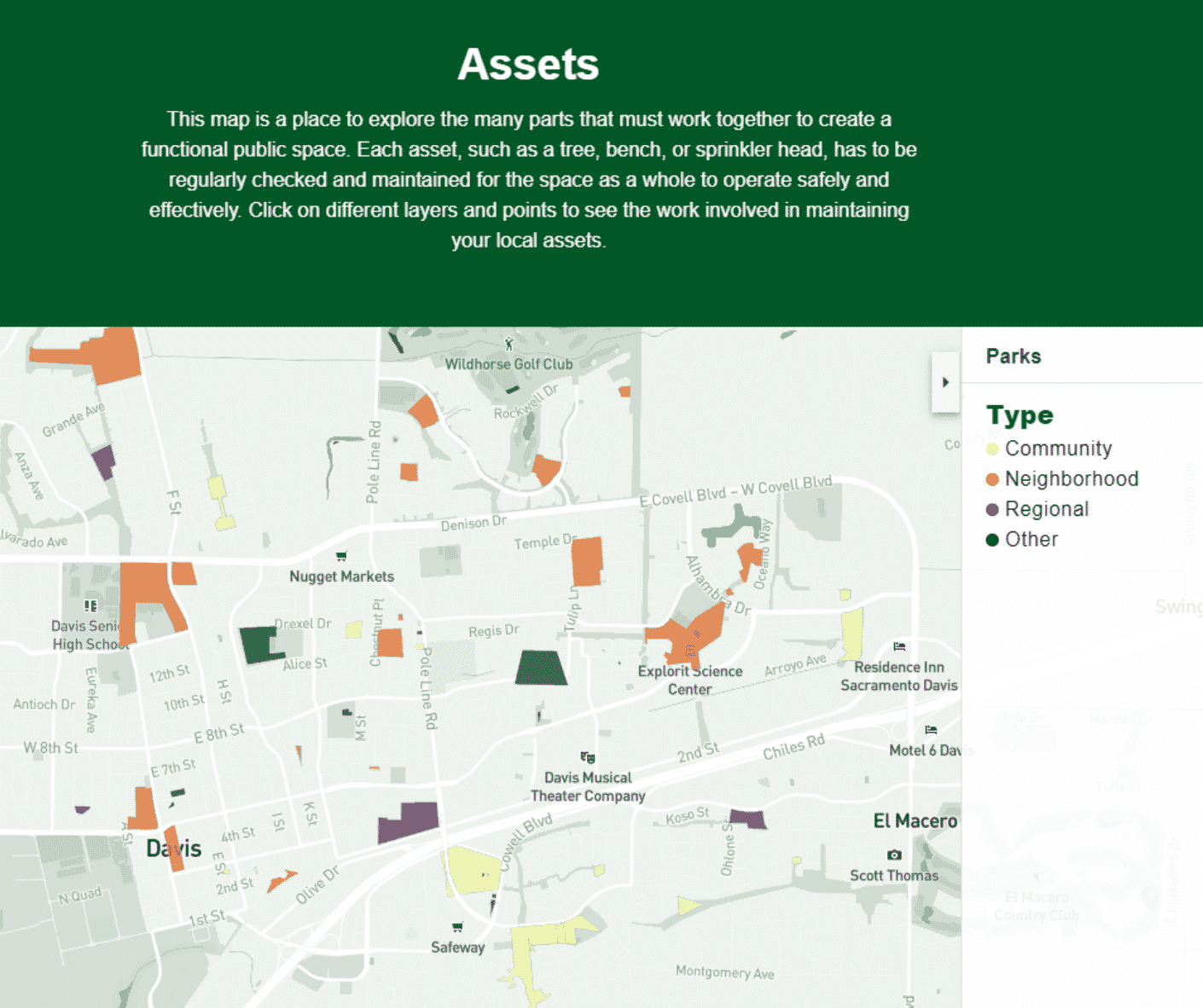
Asset Map
Our newest edition of the CEM allows you to display multiple layers of points and polygons stored with your TreePlotter INVENTORY application. For example, users can toggle between a layer of tree points, to a layer of park locations, to a layer of playground equipment. If desired, work records and photos can be shown for each asset, so users can see the hard work involved in maintaining their favorite public spaces.
Why utilize a Community Engagement Map?
At its core, a Community Engagement Map is designed to share tree data in a simple and clean format everyone can understand. A typical tree inventory often includes more information than the public would be interested in. The Community Engagement Map is configurable so clients can share a limited version of their inventory that highlights the data they most want the public to see.
Here are three of the top benefits of a CEM:
Awareness
Folks often don’t think twice about the trees shading their sidewalk or lining their route to work. We forget about our surroundings all the time, focused on a million other things. A Community Engagement Map is a platform to draw the public’s attention back to their surrounding environment by prompting them to look at and then look up their urban trees. Once that habit starts, it can be hard to shake.
Education
A CEM helps to educate community members about the urban trees right in their neighborhood or hours away. Depending on how much tree data is available, viewers can explore the trees in their area, the neighboring town, or around the state. It is an excellent way to build the connection in the public’s mind between urban trees and the myriad of ecosystem services they provide. It’s also another place to share about ongoing urban forestry programs and initiatives.
Engagement
A CEM is all about getting the public to interact with the urban forest. It can easily be integrated into citizen science programs, where community members are asked to record information about the trees in their neighborhood. The CEM can also be a resource for local school projects as well as a helpful destination to link to during stakeholder engagement campaigns.

At its core, a Community Engagement Map is designed to share tree data in a simple and clean format everyone can understand.
Who can benefit from a Community Engagement Map?
Local, County, and State Departments
Government agencies that have urban forest responsibilities have a lot to gain from a Community Engagement Map. Maintaining public trees also requires maintaining a relationship with the public. Residents can be a major ally for urban forestry efforts, providing a pool of volunteers for public events and more eyes in the community on the lookout for hazardous trees. Additionally, growing public appreciation for the urban forest through a CEM can help when advocating for budget increases.
Homeowner Associations (HOAs)
Homeowner associations are tasked with providing residents with well-maintained outdoor landscaping but can get pushback from homeowners when monthly dues are secured for common space maintenance. Residents often aren’t aware of the value brought to their home through tree and asset care efforts. The Community Engagement Map provides HOAs with a simple tool that can be readily shared with homeowners to educate them on the value of their trees. With advanced features, you can share the eco-benefits of their property trees and all trees within the association’s limits to demonstrate why tree and landscape maintenance is a significant portion of their dues. Resident can also consult the CEM to see recently completed or planned work for their trees and outdoor assets.
Universities
Colleges and universities often invest heavily in the look of their campus, and for good reason. A beautifully landscaped campus is a powerful selling tool for prospective students and an important amenity for current students and faculty. Community Engagement Maps allow universities to demonstrate how their investments in campus landscaping benefit the students. They can also act as an educational resource and be integrated into environmental coursework and student projects.
Private Tree Care Businesses
Private tree care businesses are always looking for ways to differentiate themselves from the competition. A Community Engagement Map is a new way to stand out from the pack and offer a unique value add to clients. If you have clients in any of the aforementioned categories, you can see how offering a Community Engagement Map along with your tree care services could make the difference in winning a bid.
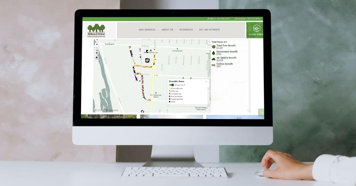
For example, Ahlum and Arbor is a tree care company that has provided Central Ohio with top notch service for over 40 years. They completed a tree inventory for the Village of Marble Cliff, a tight-knit suburb of Columbus with a lot of interest and pride in their tree-lined streets. Marble Cliff wanted a way to share the inventory with their residents. Ahlum and Arbor embedded a CEM of the inventory on their website, allowing residents to interact with the information and see the utility of an urban forest inventory.
What are the essential features of the Community Engagement Map?
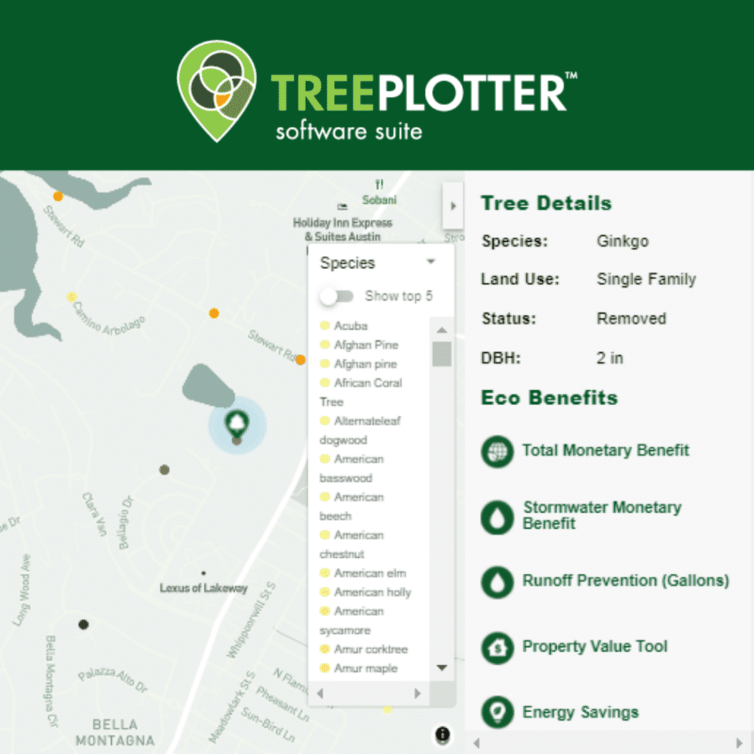
Tree Information Display
There is a wide variety of tree data that can be shared through a community engagement map and it is up to the client to decide which fields should be included. Common data fields include species, land use, diameter at breast height (DBH), condition, or planting date. Eco-benefits can also be shared, including stormwater, property value, energy savings, carbon capture, air quality improvements, and more.
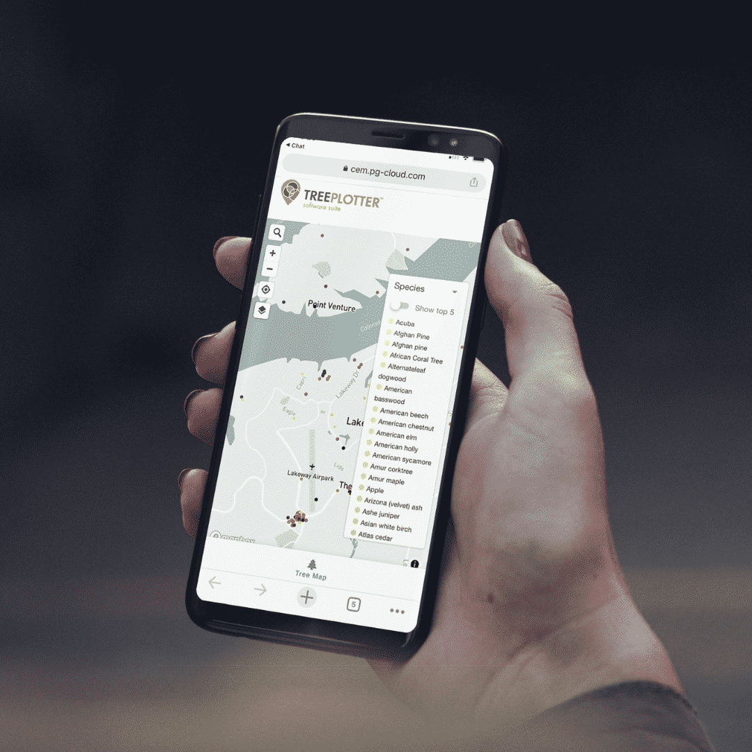
Mobile-Friendly
More than half of global internet traffic now comes from mobile devices. All public-facing websites need to have a mobile-friendly version, online tree maps included. It also just makes sense. Often a resident will get curious about urban trees while they are out and about, seeing trees in action. It is therefore essential to have that information readily available on a mobile device.
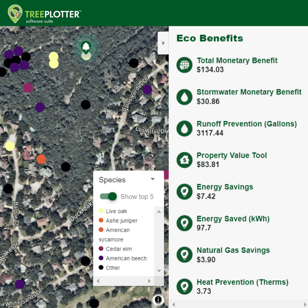
Filterable Results
Online tree engagement maps can host a mountain of data. The easiest way for users to organize that information and find answers to their questions is with filters. Any informational field can be set up to have the map color coded by that attribute. Users can then toggle through different attributes and see how the map trends change. Also included is a “Show top five” option, so users can quickly find the superlative trees in the categories of their choosing.
We would be happy to have a more specific conversation about how a Community Engagement Map could work for your business or agency. Please get in touch to learn more.
Related Resources

TreePlotter™ COMMUNITY ENGAGEMENT MAP
ARVADA (August 15, 2021) PlanIT Geo™ is excited to be releasing the Community Engagement Map, the newest core feature of the TreePlotter software suite.

Can Community Investment Reduce Crime?
Urban foresters have been examining the relationship between urban vegetation and crime rates and advocating for greater community investment for decades–so is there peer-reviewed research to provide evidence that investing in the greening of underserved communities is an effective strategy to reduce crime?
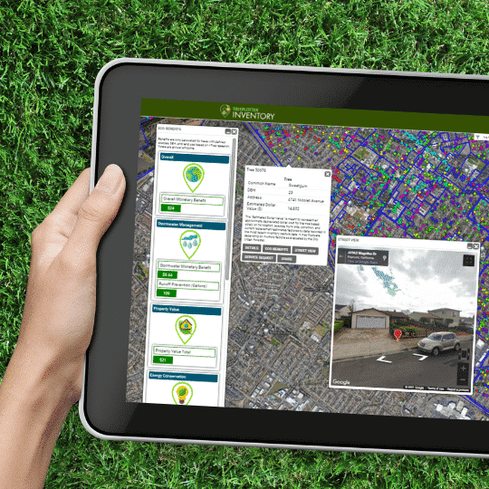
TreePlotter™ INVENTORY vs. In-House GIS
GIS lacks certain real-world functionality out in the field. This checklist explains the challenges of an in-house solution compared to the efficiencies & cost benefits that TreePlotter™ INVENTORY can bring.

Community Groups Leverage Technology
In this on-demand webinar you will hear from Tree San Diego and CANOPY of Palo Alto on how they are leveraging technology to engage their communities to achieve their tree planting initiatives.
Stay Up To Date With The Latest News and Events
Join Our Community
Stay informed on the urban forestry industry with our monthly TREEbune newsletter, live webinars, and industry-specific content delivered to your inbox.
Urban Forestry Webinars
PlanIT Geo has a substantial on-demand webinar library. Get CEU credits, grow your knowledge base, and stay current on cutting edge industry technology.
Follow Us
We love to share industry-related news, software tutorials, blogs, and company news across our social channels.
Stay Up To Date With The Latest News and Events
Join Our Newsletter
Stay informed on the urban forestry industry with our monthly TREEbune newsletter, live webinars, and industry-specific content delivered to your inbox.
Urban Forestry Webinars
PlanIT Geo has a substantial on-demand webinar library. Get CEU credits, grow your knowledge base, and stay current on cutting edge industry technology.
Follow Us
We love to share industry-related news, software tutorials, blogs, and company news across our social channels.
