The 3+30+300 Rule: How Data and Mapping Tools Are Transforming Urban Forestry
A Fresh Perspective on Greener, Healthier Communities in Fort Collins, Colorado
June 2, 2025 | Justine Petrocchi
Curious how cities are transforming green spaces with data? Let’s explore how the 3+30+300 rule is changing the game.
Imagine looking out your window and seeing trees in every direction, walking five minutes to a nearby park, and knowing your neighborhood is cool and shaded in summer. That’s the vision behind the 3+30+300 rule, a data-backed, people-focused approach making urban greening measurable and impactful.
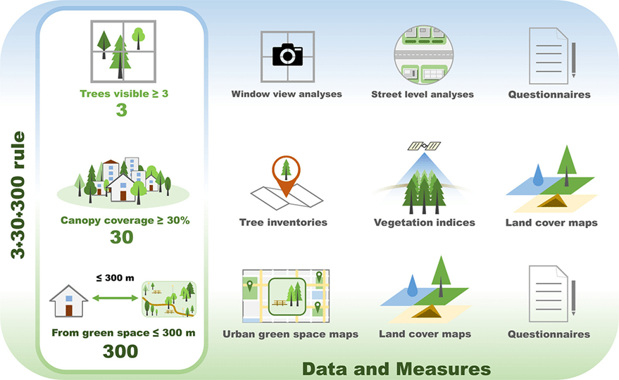
With the help of spatial analysis, cities are embracing this innovative framework:
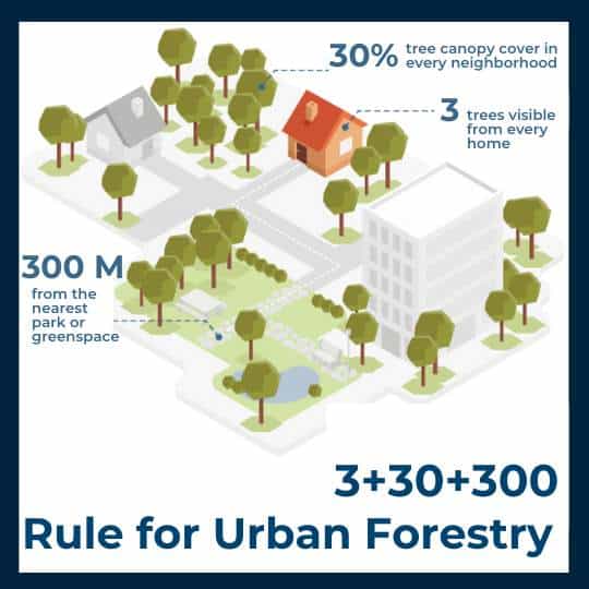
3 trees are visible from every home, school, or office
30% tree canopy cover in every neighborhood
300m to the nearest high-quality green space
These targets make complex environmental goals easier to understand and act upon, empowering planners, residents, and city leaders to create healthier, more equitable communities.
Want a full breakdown of the 3+30+300 Rule? Visit our introductory guide to explore the science behind each benchmark and why it matters.
Why It Works
The 3+30+300 rule provides a simple yet powerful formula for making cities more livable:
- 3 trees in sight can be linked to reduced stress, faster recovery, and better mental health.
- A 30% tree canopy coverage is associated with lower urban temperatures, improved sleep, and a reduced risk of heart disease.
- 300m away from a park or green space ensures that all residents have equitable access to recreation, cooling, and the benefits of nature.
These evidence-based targets turn vague goals into action-ready strategies for resilience and well-being, especially when paired with the right data and tools.
Why Urban Forests Matter for Public Health: Trees and parks aren’t just amenities—they’re critical to mental and physical well-being. Learn how the 3+30+300 rule helps cities put health first in our blog: What the Pandemic Taught Us About Urban Forests and Public Health.
Case Study: Fort Collins’ A Data-Driven Approach
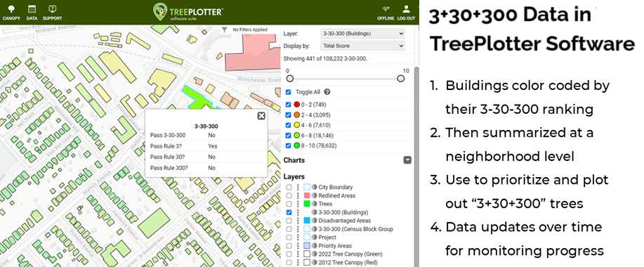
Fort Collins, Colorado, serves as a powerful example of how cities can utilize clear benchmarks to guide their urban forestry and healthy community efforts. The City adopted the 3+30+300 rule with a forward-thinking approach, using geospatial tools to assess how well it met the 3+30+300 criteria. The results were illuminating:
- Only 15% of buildings met all three benchmarks
- A canopy gap analysis pinpointed neighborhoods below the 30% threshold
- Pedestrian routes uncovered underserved “park deserts”
- Upon examining factors such as income, age, and housing stability, to gain a deeper understanding of community needs, only 0% of buildings in specific neighborhoods met all three goals, compared to 53% in other areas
With tools like TreePlotter CANOPY, Fort Collins was able to visualize gaps, prioritize neighborhoods, and plan targeted tree planting and stewardship to improve community health and quality of life.

Want to explore the full findings? Dive deeper into Fort Collins’ data-driven approach and urban forestry outcomes in the complete Fort Collins 3+30+300 Analysis Report.
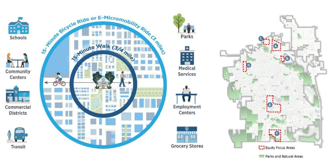
Illustration of the15-minute City concept (City of Fort Collins, CO) and Map of the Equity Focus Areas in Fort Collins according to the 15-minute City Analysis Summary
Focusing on Opportunity and Community Health in Urban Greening
The 3-30-300 rule helps ensure that all neighborhoods can enjoy the benefits of green space by making trees and parks a practical part of urban planning. This approach allows your community to:
- Identify neighborhoods with fewer trees and prioritize them for new plantings.
- Expand access to green spaces and the health benefits they provide for residents across the city.
- Involve residents in the planning process to ensure that tree planting decisions reflect the community’s needs and preferences.
By using clear, data-driven benchmarks, city leaders can promote healthier environments and enhance quality of life for everyone.
The 3+30+300 rule ensures every community can enjoy the benefits of green space, making trees and parks a fundamental part of urban planning rather than a luxury. By guiding planners to prioritize neighborhoods that do not hit the benchmarks, the 3+30+300 rule places areas with the most opportunity for improvement at the heart of urban planning decisions. It ensures investments in parks and trees are directed where they are needed most, helping to evenly disperse access to green spaces across different communities. This approach fosters active community involvement, leading to healthier urban environments and an enhanced quality of life for all residents.
In Fort Collins, high-need areas were defined by overlapping indicators, low tree canopy coverage, limited park access, and high social vulnerability. To address these gaps, the city redirected 78% of new tree plantings to neighborhoods most in need. Community forums and surveys helped ensure planting decisions reflected local priorities, while new maintenance programs focused on trees in vulnerable zones requiring urgent care. This approach ensured both immediate impact and long-term stewardship where it was needed most; This people-first approach strengthens trust, resilience, and health outcomes.
Using a tool like NatureScore™ allows communities to measure the physical and mental health benefits of urban greening in a clear, data-driven way. By analyzing access to trees and parks, NatureScore offers valuable insights into how green spaces support public well-being and contribute to achieving the goals of the 3+30+300 rule. Discover how NatureScore tracks the positive impacts of nature on community health.
Climate Resilience Starts with Trees
The framework helps cities confront rising temperatures, flooding, and air quality challenges through measurable, adaptive strategies. While outcomes vary based on local climate conditions, the need for flexible implementation is clear. As cities face increasing climate stress, tailoring the 3+30+300 rule to local environments, through species selection, irrigation strategies, and thoughtful design, ensures long-term impact. Fort Collins adapted its strategy to fit its unique context by:
- Extending park buffers to 500 meters in low-vegetation areas, allowing slightly longer distances to parks in neighborhoods with sparse greenery, while ensuring safe and connected access through shaded corridors or greenways.
- Prioritizing drought-tolerant native species, selected for resilience to local conditions and reduced water needs.
- Installing irrigation systems aligned with stormwater capture, resulting in a 37% reduction in water use and more sustainable maintenance.
- Preserving cultural sightlines in historic districts through thoughtful, context-sensitive planting that balances greenery with the protection of important views and landmarks.
Fort Collins shows that with the right tools and community engagement, any city can adapt the 3+30+300 rule to its landscape. You can do the same by:
- Adjusting park access buffers based on population density, shortening distances in compact neighborhoods to improve walkability, or extending them in rural areas with more open space.
- Designing green corridors along walking and biking trails with climate-resilient vegetation to provide natural habitat and biodiversity, and connect communities to larger parks.
- Preserving views in culturally or historically significant areas using selective planting, such as smaller or columnar trees, or strategic pruning, that maintains visibility while enhancing the urban forest.
From Singapore to Seattle, the rule provides a smart, flexible approach that transforms cities.
A 25-Year Blueprint: Change Takes Time and Planning
A phased 25-year approach ensures sustained progress. Key components of an implementation blueprint for the 3+30+300 rule in urban forestry are: assessment, phased goals, supportive policies, community engagement, monitoring and reporting, and challenge solutions. Fort Collins mapped out a phased strategy to ensure steady progress.
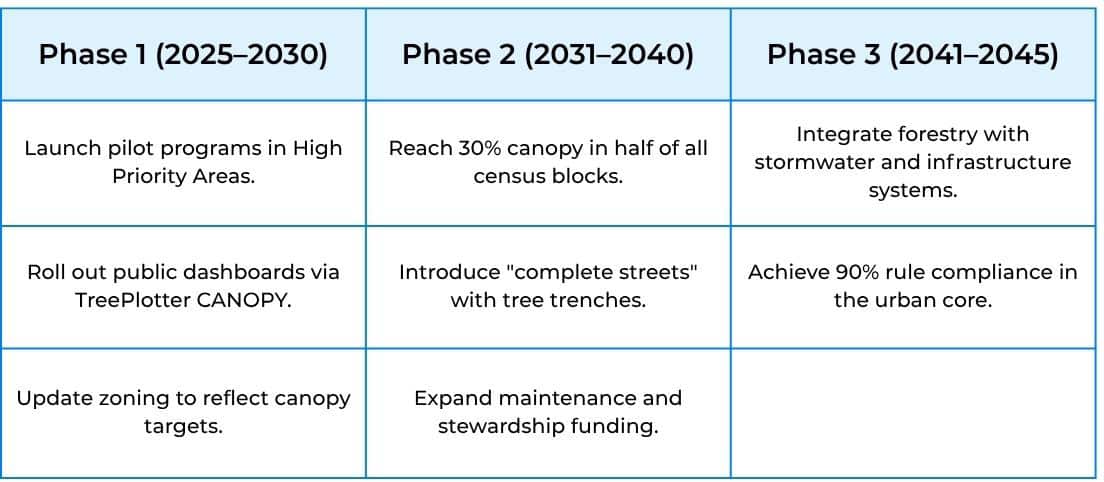
Why The 3+30+300 Rule Matters
The 3+30+300 rule is more than just a guideline; it’s a proven path to healthier, more resilient, and sustainable cities. By integrating this rule with TreePlotter CANOPY, users can easily visualize canopy and park access gaps, involve local communities in practical solutions, and track progress with transparency.
Fort Collins Impact Snapshot:
- 15% of buildings met all three goals
- 78% of new plantings targeted neighborhoods with fewer trees
- 37% irrigation savings achieved through improved stormwater systems
Clear data and practical tools now guide urban greening. With community participation and a focus on measurable results, every neighborhood can benefit and thrive. Let’s create a greener, healthier urban future together—one tree, one park, and one neighborhood at a time.
Get started with the 3+30+300 rule today. We’re here to help.
Related Resources
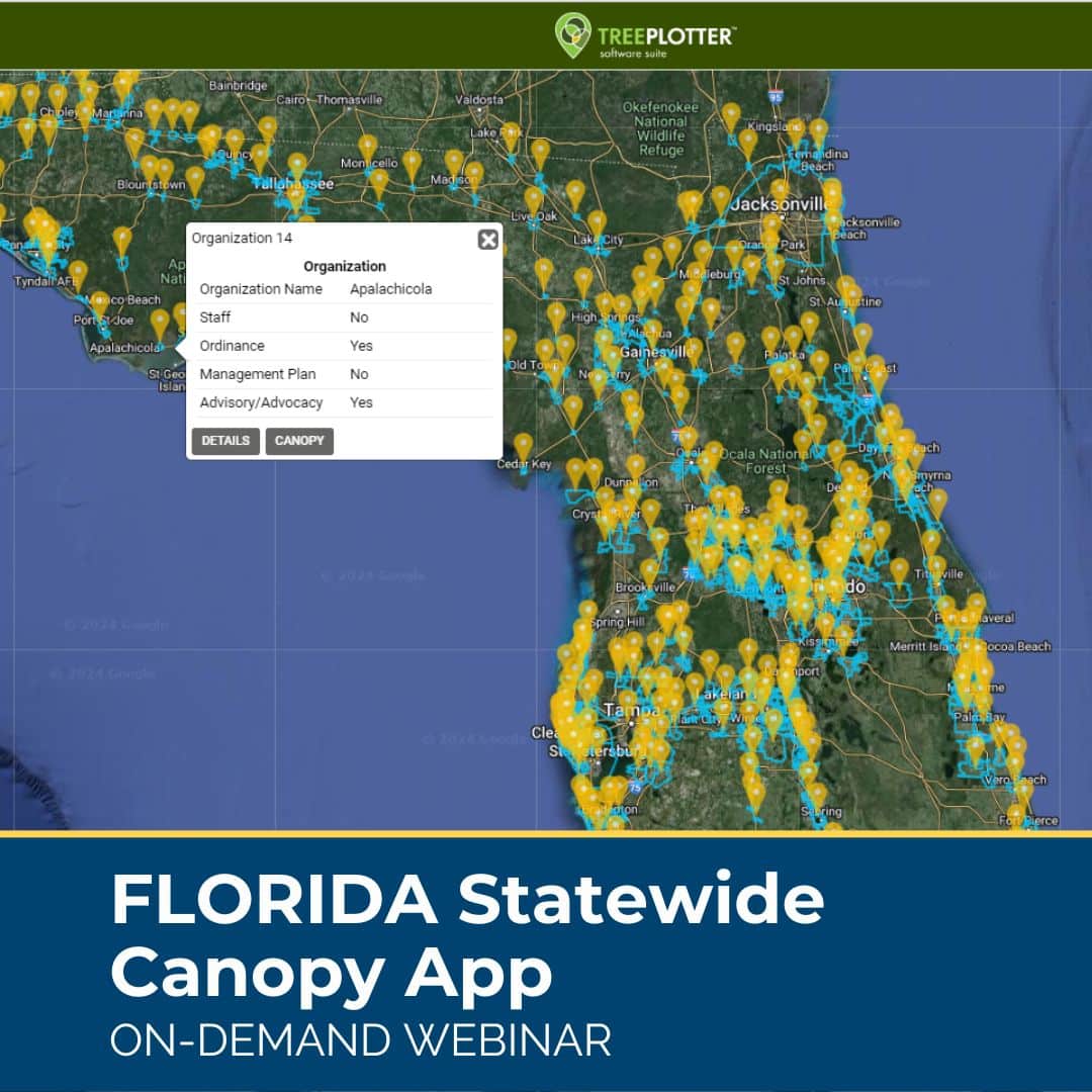
Florida Statewide Tree Canopy App
ON-DEMAND WEBINAR: An incredible, free urban forest resource is now available to Florida communities: an urban tree canopy assessment of 488 Florida cities, towns, and Census Designated Places. See how communities can freely view and analyze the canopy results of their community on an interactive web application.
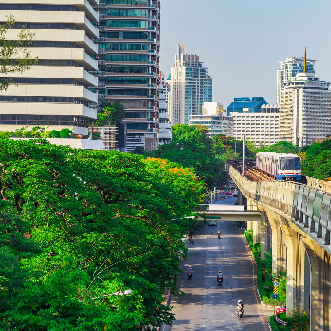
Urban Forestry and Heat Mitigation 101: Free Guide
This guide covers opportunities at the intersection of urban forestry and heat mitigation, including the fundamentals of urban heat, methods to measure heat and tree canopy, and urban forest strategies for heat mitigation.
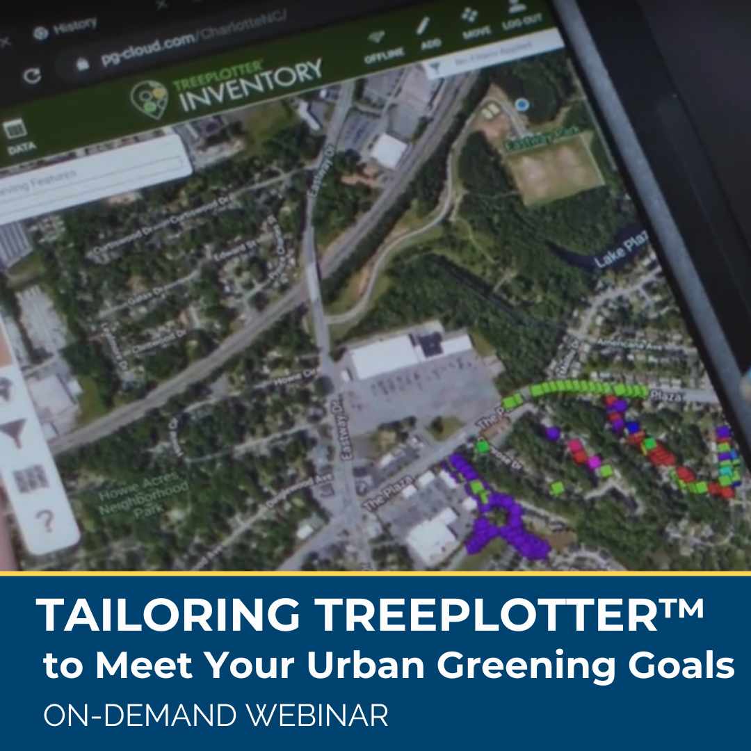
Managing Your Urban Forest From a Statewide View
ON-DEMAND WEBINAR: Statewide tree inventories provide a unique scale for tracking and managing urban forests. By centralizing dozens of community tree inventories in one place urban forest managers can identify larger, regional trends and make more informed decisions, such as how species diversity looks at the metropolitan level, not just the municipality scale.
Learn how statewide inventories in Oregon and Wisconsin guide high-level state management decisions and empower individual communities, how their statewide inventories are launched, and the benefits and challenges of creating these massive datasets.
Urban Forestry’s New Benchmark: The 3+30+300 Rule
In 2021 Cecil Konijnendijk, Director at the Nature Based Solutions Institute, proposed a new guideline for greener, healthier, more resilient cities: the 3+30+300 rule. The rule sets three minimum criteria for urban trees and green space: At least 3 trees in sight from every home, school, and workplace, At least 30% tree canopy in every neighborhood, and No more than 300 meters between every home and the nearest park or green space. Learn more in this blog post.
Stay Up To Date With The Latest News and Events
Join Our Community
Stay informed on the urban forestry industry with our monthly TREEbune newsletter, live webinars, and industry-specific content delivered to your inbox.
Urban Forestry Webinars
PlanIT Geo has a substantial on-demand webinar library. Get CEU credits, grow your knowledge base, and stay current on cutting edge industry technology.
Follow Us
We love to share industry-related news, software tutorials, blogs, and company news across our social channels.
Stay Up To Date With The Latest News and Events
Join Our Newsletter
Stay informed on the urban forestry industry with our monthly TREEbune newsletter, live webinars, and industry-specific content delivered to your inbox.
Urban Forestry Webinars
PlanIT Geo has a substantial on-demand webinar library. Get CEU credits, grow your knowledge base, and stay current on cutting edge industry technology.
Follow Us
We love to share industry-related news, software tutorials, blogs, and company news across our social channels.

