This Is How You Measure The Impacts of Nature On Public Health
New tools are making the positive impacts of nature exposure on public health measurable and practical
March 28, 2022 | Alec Sabatini

For at least the last two decades there has been a steadily growing campaign to get governments and the public to see urban forests as essential infrastructure. The backbone of this campaign has been the quantification and monetization of ecosystem services. Tree benefits, while vital to the livability of our communities, lacked a formal market like other traditional public services, and were therefore viewed as free and taken for granted. Then tools like i-Tree arrived on the scene, and urban forest managers were able to reference exact dollar amounts when advocating the value of trees.
While improved public health is widely accepted as a benefit provided by urban forests, these positive impacts have been harder to quantify than other benefits, like stormwater reduction or energy savings. Different components of public health impacts have been calculated, such as air pollutant reduction, but a broader quantification of health benefits has been more elusive.
Over the last 40 years, hundreds of peer reviewed observational and interventional studies have tracked millions of individuals around the world on a range of positive health outcomes in relation to nature exposure.
From Complex to Actionable
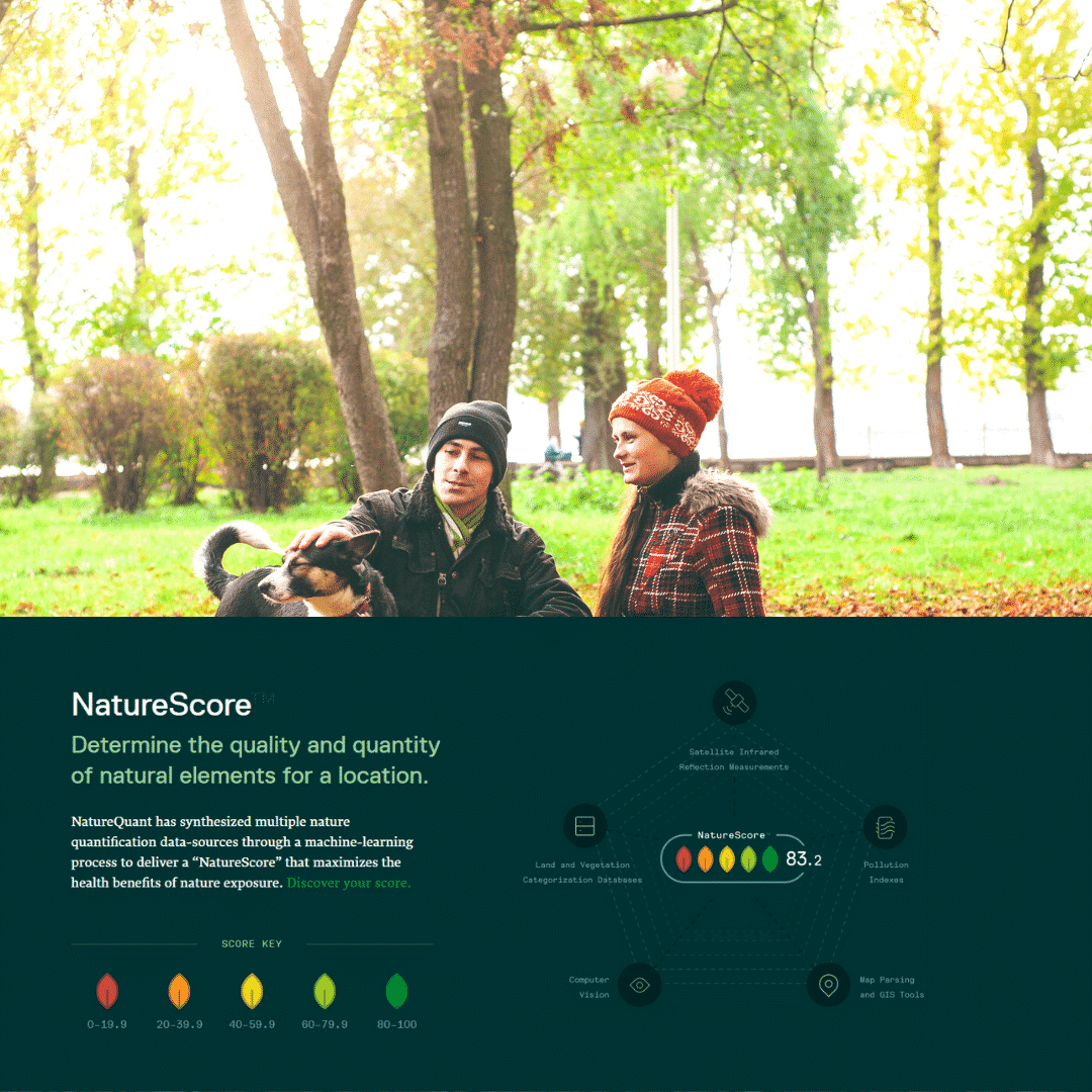
How can the well-documented health impacts of nature exposure be condensed into an actionable form? Let’s look at the process of NatureScore™, a tool from one of PlanIT Geo’s partners, NatureQuant.
It starts with identifying where nature exists. For NatureScore this involves an aggregation of 30 different data sources to locate both green space (urban parks, public open spaces, street trees, landscaped plant-life) and blue space (rivers, lakes, canals, waterfalls, and even some human-made water features). These data sources include computer vision processes for analyzing aerial and satellite imagery, pollution indices, and vegetation databases.
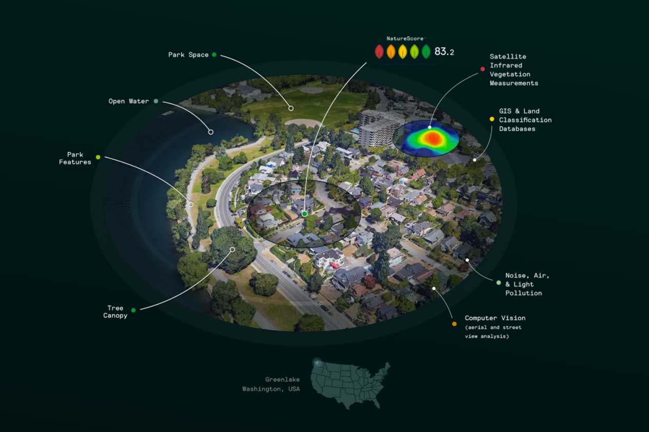
The geolocated nature elements are then processed by machine learning algorithms to develop a 0 – 100 score and quintiles of one-five color-coded “leafs” representing the health impacts of nature for a certain radius around a location. A high NatureScore has a strong positive association with increased longevity, and reductions in negative outcomes like cancer, diabetes, and cardiovascular disease. The NatureScore map identifies not just where nature exists, but where quality nature leading to improved health outcomes exists and where it is deficient.
These analyses are currently available for purchase from PlanIT Geo for any location in the United States, and expansions to all of North America and Europe are underway. You also check how your own address scores right now. As the component data sources are updated, so is NatureScore, that way the scores represent the most topical information available.
The goal of this data is to promote the use of nature not only for public health but also as an equity tool. One of the best ways to do this is to spotlight areas for researchers, nonprofits, municipalities, and others that could most benefit from increased nature. The NatureScore Priority Index (NPI) layers 17 socioeconomic variables, such as income, education, and housing quality, onto the NatureScore rating. The 0-10 NPI rating identifies areas both nature deprived and with socioeconomic disadvantages. In this way, analyzing the nexus between nature and public health through mapping technology becomes an actionable, interventional tool for governments and nonprofits to prioritize their efforts in disadvantaged communities.
Other Nature Quantification Tools
NatureScore is part of a growing ecosystem of tools providing a range of insights for anyone looking to improve the livability of our cities.
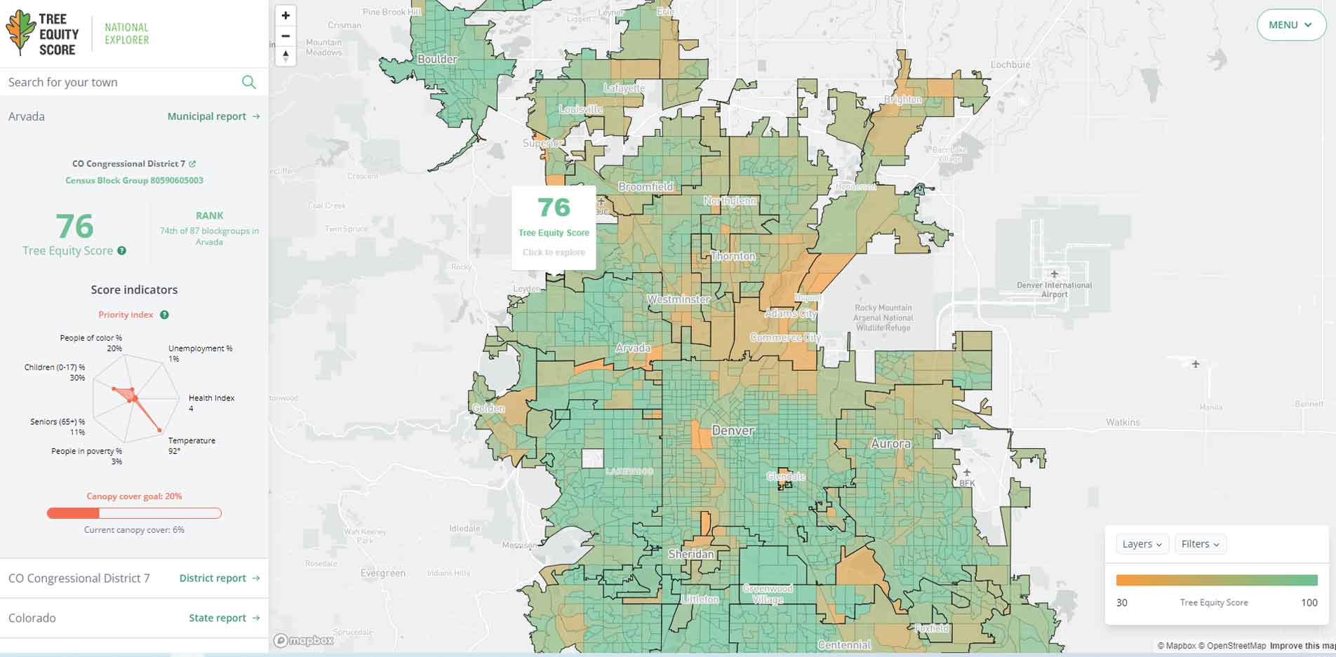
The Tree Equity Score from American Forests takes a quantitative look at how maps of tree cover in any city in the United States are far too often a map of race and income too. Explore their interactive map to see how different cities and census block groups compare on the 0-100 Tree Equity Score.
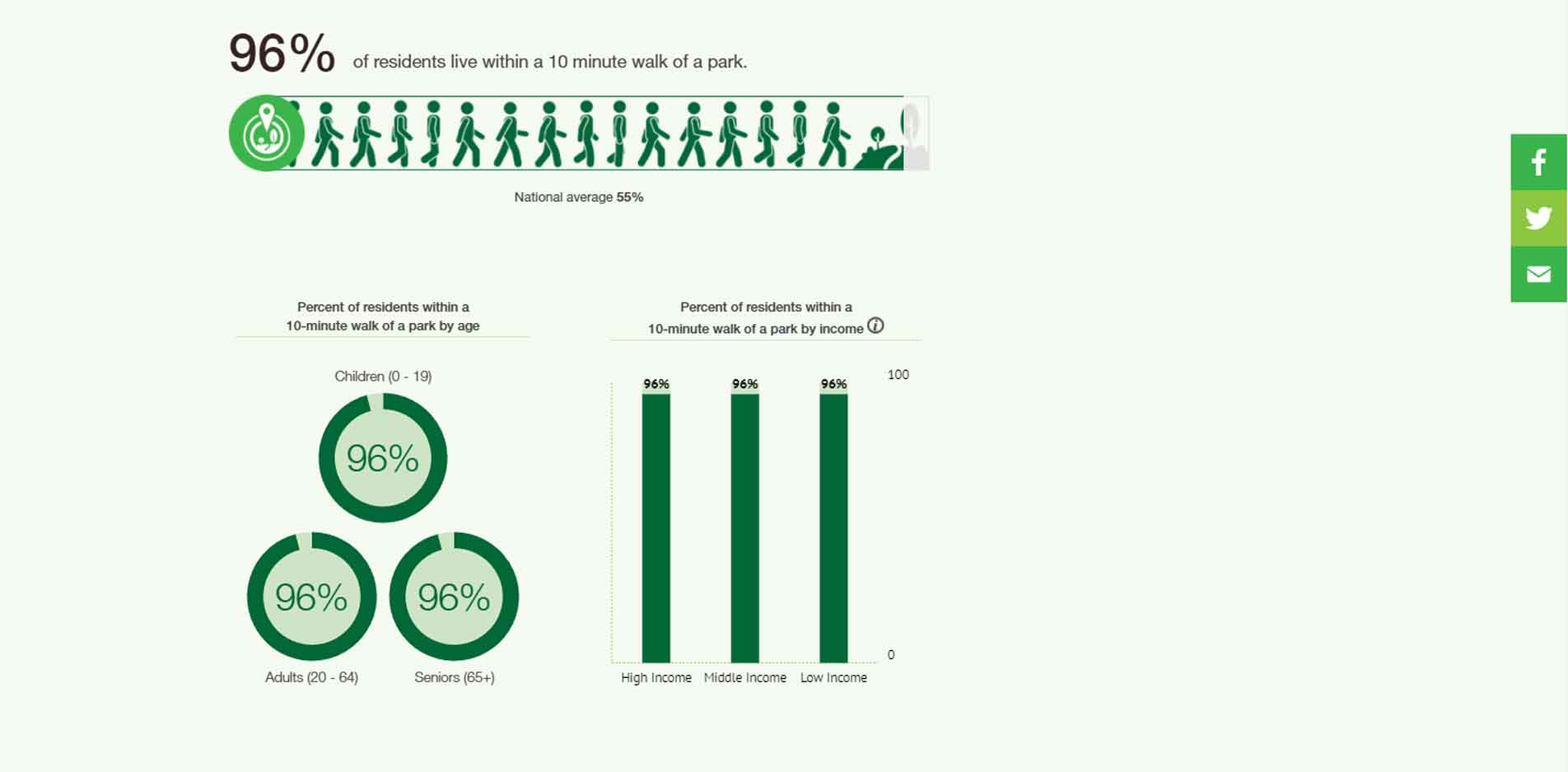
ParkScore, from Trust for Public Lands, looks specifically at the access United States residents have to parks, defined as a park within a 10-minute walking distance. Try searching your own city to see how it fairs in park accessibility and how accessibility changes across age, race, and income.
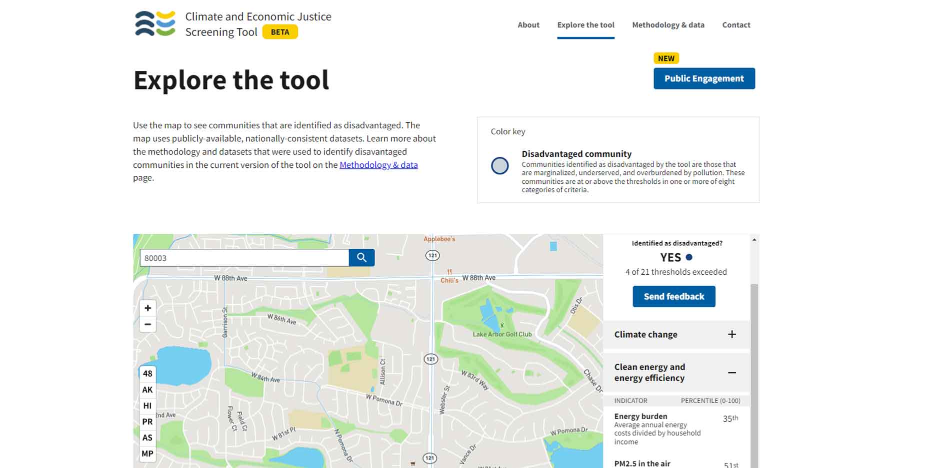
From the federal government, there is the Climate and Economic Justice Screening Tool, which maps out communities that are marginalized, underserved, and overburdened by pollution. The tool analyzes census tracts on eight metrics, including climate change, workforce development, health burdens, and clean transit.
What makes NatureQuant unique is bringing together elements of “beneficial nature” which research shows will yield the greatest public health improvements, overlaid with disadvantaged communities, and incorporated into TreePlotter™ software products.
Mapping a Greener Future
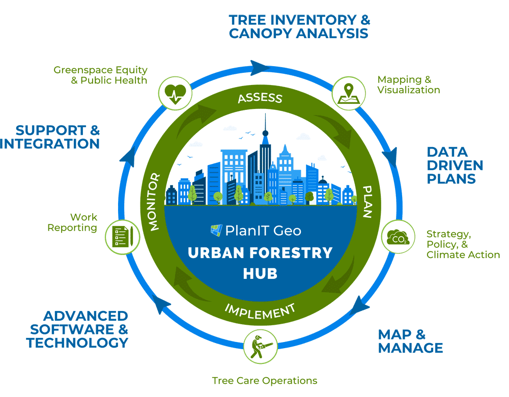
Our vision at PlanIT Geo is to be the central hub of urban forestry solutions, especially when it comes to innovative technology. With that in mind, a partnership with NatureQuant was an important next step to offer clients a new perspective on how to manage their greenspace for maximum effect.
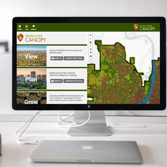
As a global leader in urban forestry software, tree canopy analysis data, and associated planning services, PlanIT Geo is the ideal distributor for NatureQuant’s information products and is now the exclusive provider for direct data sales. We are also incorporating NatureScore and NatureScore Priority Index into our TreePlotter software products as well as reports, plans, and consulting services for customers.
Limited Time Promotional Pricing
We will be offering promotional pricing until May 31st to anyone who adds NatureQuant National Relative data to a new or existing TreePlotter™ INVENTORY or CANOPY application. Fill out this form to learn more about the offer and to stay updated on NatureScore’s integration with TreePlotter software.
Related Resources
Putting a Number on the Health Benefits of Nature
This on demand webinar explores how NatureQuant is using innovative tech, machine learning, and big-data to quantify nature exposure and potential health benefits, the tools they’ve created to share this data, and how this information will be incorporated into PlanIT Geo’s software and services thanks to a new partnership.
What We Can learn From Charlotte’s Urban Forest
Charlotte has won the top prize on the Husqvarna Urban Green Space Index (HUGSI) for two years running. By a multitude of metrics, Charlotte has a world class urban forest. In this eBook we explore what exactly the city has been doing so well when it comes to urban forest management. After detailing the history of Charlotte’s urban forest and the eBook focuses on three key areas of innovation
What You Need to Know About Urban Tree Canopy and Artificial Intelligence
Our new subscription-based, artificial intelligence-driven tree canopy data is disrupting the traditional tree canopy mapping and assessment process that has been the status quo for over a decade. Naturally, that is generating some discussion around methods, accuracy, human intervention, and data ownership. We’re glad to be a central figure in the conversation and at the leading edge of the industry. We’d like to further that discussion by exploring some of the recurring topics we are seeing come up around Urban Tree Canopy and Artificial Intelligence.
How to Communicate the Benefits of Trees to Your Community
Effective advocacy for urban forestry largely hinges on being able to communicate just how much trees are contributing to their community. For those who work in urban forestry, the benefits of trees are a well-established fact. The general public however, tends to have a limited understanding of tree benefits, both in scope and depth.
Stay Up To Date With The Latest News and Events
Join Our Community
Stay informed on the urban forestry industry with our monthly TREEbune newsletter, live webinars, and industry-specific content delivered to your inbox.
Urban Forestry Webinars
PlanIT Geo has a substantial on-demand webinar library. Get CEU credits, grow your knowledge base, and stay current on cutting edge industry technology.
Follow Us
We love to share industry-related news, software tutorials, blogs, and company news across our social channels.
Stay Up To Date With The Latest News and Events
Join Our Newsletter
Stay informed on the urban forestry industry with our monthly TREEbune newsletter, live webinars, and industry-specific content delivered to your inbox.
Urban Forestry Webinars
PlanIT Geo has a substantial on-demand webinar library. Get CEU credits, grow your knowledge base, and stay current on cutting edge industry technology.
Follow Us
We love to share industry-related news, software tutorials, blogs, and company news across our social channels.

