A Holistic Approach to Urban Forestry
Complete Urban Forestry Services in Rochester, Minnesota
July 1, 2020 | Carrie Asselmeier

This project will bring that to life once again by not only completing an urban tree canopy assessment but also including an urban forest master plan developed by our Urban Forestry Consulting team.
Urban Tree Canopy Assessment
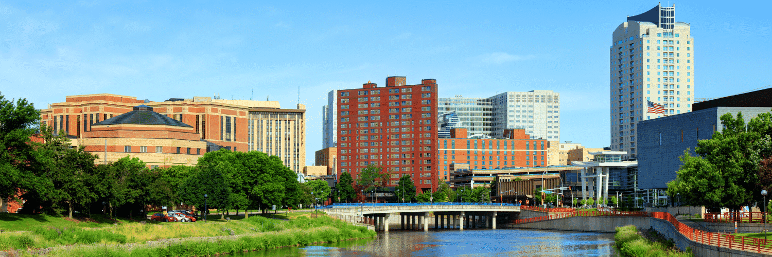
The City of Rochester, MN, nestled in a valley along the south fork of the Zumbro River, is home to over 114,000 people. The City strives to enhance its community pride by improving the physical, environmental, economic, cultural, and social quality of the community. The City of Rochester Parks Department’s Forestry Division is responsible for the management of a comprehensive urban tree program including the reforestation of park and boulevard areas and the maintenance of more than 100,000 boulevard and public property trees located on more than 3,900 acres. Partnered with RNeighborWoods, the Forestry Division also engages community members in urban forestry through “Citizen Forester” training and accreditation.
Urban Forest Master Plan
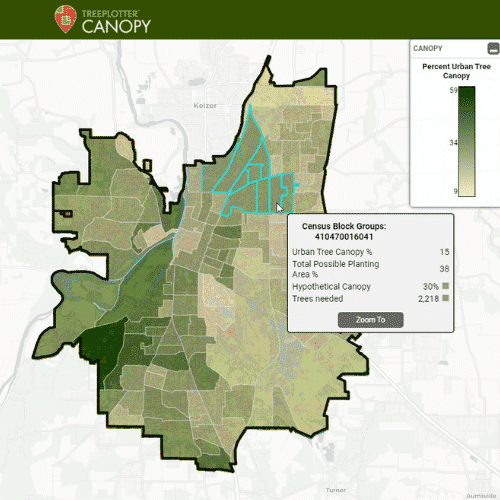
The City’s urban forest plays an integral role in enhancing the quality of the community environment physically, economically, and socially by providing many benefits. The City of Rochester Parks Department Forestry Division has partnered with PlanIT Geo to develop an Urban Tree Canopy Assessment and Urban Forest Master Plan to define the value of trees in enhancing the quality of the community. The canopy analysis will include a tree canopy assessment that provides the City with a view of canopy cover across various scales and will provide the City with Urban Tree Canopy (UTC) and Potential Plantable Area (PPA) metrics to establish canopy cover targets. To develop the strategies necessary to achieve the City’s mission, the City will utilize the data from the canopy analysis to develop a public engagement-supported comprehensive Urban Forest Master Plan for Rochester.
The City’s urban forest plays an integral role in enhancing the quality of the community environment physically, economically, and socially by providing many benefits.

Complete Urban Forestry Services
Read the final Urban Forest Master Plan including the full analysis from the Urban Tree Canopy Assessment for Rochester (Coming July 2021) to see another great example of how a canopy analysis can benefit your urban forest.
To find out more about PlanIT Geo’s complete urban forestry services, check out our recently published story map for an in-depth overview of our services!
Related Resources

How To Set Effective, Evidence-Based Urban Tree Canopy Goals
Urban tree canopy goals must walk a careful line of ambition, inspiration, and practicality. To encourage well-informed canopy cover goals we have assembled some best practices to help communities find the right target for them.

Growing a Sustainable Urban Forest in Colorado Springs
Learn how one city is putting PlanIT Geo™ services to work to understand the past, present, and future of their community’s trees.

Get Your Urban Tree Canopy Assessment TOMORROW
We are the first in our industry to provide 60-cm resolution land cover data built into an interactive tree canopy software tool, making it simple for you to view, plan and achieve your tree canopy goals. Off-the-shelf tree canopy analysis for the lower 48 is already completed.

How to Leverage Your Tree Canopy Data
Tree canopy assessments provide detailed data to perform a variety of next steps. In this on-demand webinar, you will hear from past clients how they leveraged their tree canopy data.
Stay Up To Date With The Latest News and Events
Join Our Community
Stay informed on the urban forestry industry with our monthly TREEbune newsletter, live webinars, and industry-specific content delivered to your inbox.
Urban Forestry Webinars
PlanIT Geo has a substantial on-demand webinar library. Get CEU credits, grow your knowledge base, and stay current on cutting edge industry technology.
Follow Us
We love to share industry-related news, software tutorials, blogs, and company news across our social channels.
Stay Up To Date With The Latest News and Events
Join Our Newsletter
Stay informed on the urban forestry industry with our monthly TREEbune newsletter, live webinars, and industry-specific content delivered to your inbox.
Urban Forestry Webinars
PlanIT Geo has a substantial on-demand webinar library. Get CEU credits, grow your knowledge base, and stay current on cutting edge industry technology.
Follow Us
We love to share industry-related news, software tutorials, blogs, and company news across our social channels.
